|
search place name
|
||
Stenberga (Jönköping, Sweden)Stenberga is a town in the Jönköping region of Sweden. An overview map of the region around Stenberga is displayed below.
regional and 3d topo map of Stenberga, Sweden ::

Stenberga airports ::
The nearest airport is HLF - Hultsfred, located 34.5 km north east of Stenberga.
Other airports nearby include VXO - Vaxjo Kronoberg (59.3 km south west), OSK - Oskarshamn (66.2 km east), KLR - Kalkmar Kalmar (88.6 km south east), JKG - Joenkoeping Jonkoping (93.6 km north west), Nearby towns ::
Boda (2.0km east) //
Ödmundetorp (3.7km south) //
Sjökullen (2.7km south east) //
Idanäs (2.7km south west) //
Penningetorp (2.7km south west) //
Tolja (5.6km north) //
Näshult (5.6km south) //
Haddarp (5.6km south) //
Fäglakulla (3.5km south west) //
Serarp (5.9km south) //
Skirö (5.9km north) //
Nässja (6.3km south west) //
Götestorp (7.7km south) //
Loaklev (8.0km north) //
Skönberga (8.0km north) //
Hillhult (8.0km south) //
Lillarp (6.8km north west) //
Byestad (8.4km north west) //
[all distances 'as the bird flies' and approximate] 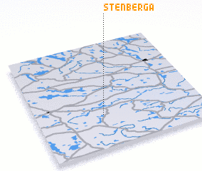 Places with similar names to Stenberga, Sweden ::
// Sittenberg (AT)
// Steinberg (AT)
// Steinberg (AT)
// Steinberg (AT)
// Steinberg (AT)
// Steinberg (AT)
// Stanebrook (US)
// Stoneybrook (US)
// Seitenbrück (DE)
// Siedenberg (DE)
Disclaimer :: Information on this page comes without warranty of any kind |
||
|
Where is Stenberga? Elevation and coordinates ::
Latitude (lat): 57°19'0"N Longitude (lon): 15°24'0"E
Elevation (approx.): 243m (map arrows pan, magnifying glasses zoom) |
||
|
Visiting Stenberga? Hotel/Accommodation ::
Book a hotel in Stenberga Travel Guide ::
Buy a travel guide for Sweden rental cars ::
car rental offers GPS waypoint ::
download a GPX waypoint (PoI) of Stenberga for your GPS receiver
|
||