|
search place name
|
||
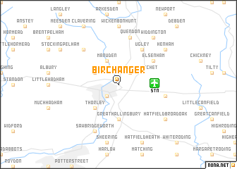
Birchanger (United Kingdom)Birchanger is a town in United Kingdom. An overview map of the region around Birchanger is displayed below.
regional and 3d topo map of Birchanger, United Kingdom ::
Birchanger airports ::
The nearest airport is STN - London Stansted, located 3.6 km east of Birchanger.
Other airports nearby include CBG - Cambridge (35.8 km north), LTN - London Luton (38.0 km west), LCY - London City (43.0 km south), SEN - Southend (49.6 km south east), Nearby towns ::
Bishops Stortford (2.2km south west) //
Stansted Mountfitchet (2.2km north east) //
Farnham (2.9km north west) //
Manuden (3.9km north) //
Thorley (4.4km south west) //
Great Hallingbury (5.6km south) //
Elsenham (5.1km north east) //
Ugley (6.0km north) //
Takeley (4.9km east) //
Quendon (7.5km north) //
Berden (6.5km north west) //
Sawbridgeworth (7.8km south) //
Hatfield Broad Oak (7.2km south east) //
Henham (7.2km north east) //
Widdington (8.2km north east) //
[all distances 'as the bird flies' and approximate] 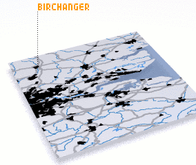 Places with similar names to Birchanger, United Kingdom ::
// Birch Hanger (US)
Disclaimer :: Information on this page comes without warranty of any kind |
||
|
Where is Birchanger? Elevation and coordinates ::
Latitude (lat): 51°53'0"N Longitude (lon): 0°11'0"W
Elevation (approx.): 86m (map arrows pan, magnifying glasses zoom) |
||
|
Visiting Birchanger? Hotel/Accommodation ::
Book a hotel in Birchanger Travel Guide ::
rental cars ::
car rental offers GPS waypoint ::
download a GPX waypoint (PoI) of Birchanger for your GPS receiver
|
||