|
search place name
|
||
Dunmoran (Sligeach, Ireland)Dunmoran is a town in the Sligeach region of Ireland. An overview map of the region around Dunmoran is displayed below.
regional and 3d topo map of Dunmoran, Ireland ::

Dunmoran airports ::
The nearest airport is SXL - Sligo, located 8.2 km east of Dunmoran.
Other airports nearby include NOC - Connaught (39.9 km south), ENK - Enniskillen St Angelo (71.2 km east), GWY - Galway (108.3 km south), LDY - Londonderry Eglinton (132.9 km north east), Nearby towns ::
Toberawnaun (0.7km south) //
Skreen (2.4km south) //
Lecarrow (3.7km south) //
Carrowcaslan (2.7km west) //
Doonflin Lower (3.6km south west) //
Aughris (3.2km west) //
Dromard (4.0km south east) //
Ardogelly (3.7km west) //
Kilrusheighter (3.7km west) //
Belturlin (4.0km west) //
Brockagh (4.4km south east) //
Carrowreagh (4.2km east) //
Chapel Street (6.7km south east) //
Lugdoon (6.3km south west) //
Raghly (9.0km north east) //
[all distances 'as the bird flies' and approximate] 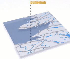 Places with similar names to Dunmoran, Ireland ::
// Doña Marina (ES)
// Tanamarina (MG)
// Tanamarina (MG)
// Tanamarina (MG)
// Tanimarina (MG)
// Tanimarina (MG)
// Doña Mariana (MX)
// Diéné Maréna (GN)
// Diano Marina (IT)
// Dona Mariana (BR)
Disclaimer :: Information on this page comes without warranty of any kind |
||
|
Where is Dunmoran? Elevation and coordinates ::
Latitude (lat): 54°15'51"N Longitude (lon): 8°43'20"W
Elevation (approx.): 4m (map arrows pan, magnifying glasses zoom) |
||
|
Visiting Dunmoran? Hotel/Accommodation ::
Book a hotel in Dunmoran Travel Guide ::
Buy a travel guide for Ireland rental cars ::
car rental offers GPS waypoint ::
download a GPX waypoint (PoI) of Dunmoran for your GPS receiver
|
||