|
search place name
|
||
Lakušije (Croatia)Lakušije is a town in Croatia. An overview map of the region around Lakušije is displayed below.
regional and 3d topo map of Lakušije, Croatia ::

Lakušije airports ::
The nearest airport is OSI - Osijek, located 79.2 km east of Lakušije.
Other airports nearby include ZAG - Zagreb (143.4 km west), SJJ - Sarajevo (173.5 km south), SPU - Split (233.8 km south west), Nearby towns ::
Granje (1.9km north) //
Sesvete (1.3km east) //
Trapari (1.4km west) //
Ćošinci (2.0km north east) //
Cerovac Jakšićki (2.9km north) //
Ašikovci (2.4km south east) //
Novoselci Jakšićki (2.2km west) //
Gradac (3.1km south) //
Rajsavci (3.0km north west) //
Radnovac (3.0km north west) //
Šumanovci (3.6km north) //
Ivanin Dvor (4.0km south) //
Gložđe (4.3km south west) //
Blacko (4.1km south west) //
Tominovac (5.3km north) //
Viskovci-Požeški (4.2km south west) //
Grabarje (4.2km north east) //
Bjeliševac (5.1km north east) //
Jakšić (4.3km north west) //
Pleternica (5.9km south) //
Blacko-Jakšić (4.4km west) //
Resnik Požeški (5.6km south east) //
Zarilac (4.4km east) //
Srednje Selo (4.7km south west) //
Ferovac (5.6km north east) //
Kuzmica (4.7km west) //
Svilna (5.8km south east) //
Ovčara (6.5km north) //
Buk (5.9km south east) //
[all distances 'as the bird flies' and approximate] 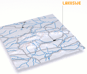 Places with similar names to Lakušije, Croatia ::
Disclaimer :: Information on this page comes without warranty of any kind |
||
|
Where is Lakušije? Elevation and coordinates ::
Latitude (lat): 45°20'28"N Longitude (lon): 17°48'50"E
Elevation (approx.): 148m (map arrows pan, magnifying glasses zoom) |
||
|
Visiting Lakušije? Hotel/Accommodation ::
Book a hotel in Lakušije Travel Guide ::
Buy a travel guide for Croatia rental cars ::
car rental offers GPS waypoint ::
download a GPX waypoint (PoI) of Lakušije for your GPS receiver
|
||