|
search place name
|
||
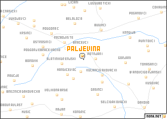
Paljevina (Croatia)Paljevina is a town in Croatia. An overview map of the region around Paljevina is displayed below.
regional and 3d topo map of Paljevina, Croatia ::
Paljevina airports ::
The nearest airport is OSI - Osijek, located 41.4 km east of Paljevina.
Other airports nearby include SJJ - Sarajevo (175.7 km south), SPU - Split (260.9 km south west), Nearby towns ::
Bračevci (2.7km north) //
Potnjani (1.9km east) //
Drenje (2.8km south) //
Bučje Gorjansko (3.8km north west) //
Pridvorje (4.6km south) //
Slatinik Drenjski (3.5km west) //
Mandičevac (4.3km south west) //
Kućanci Ðakovački (4.6km south east) //
Razbojište (4.9km north west) //
Preslatinci (5.9km south east) //
Budimci (7.2km north east) //
Bela Loza (8.2km north) //
Gašinci (8.2km south) //
Podgorač (7.8km north west) //
Veliko Nabrđe (9.1km south west) //
[all distances 'as the bird flies' and approximate] 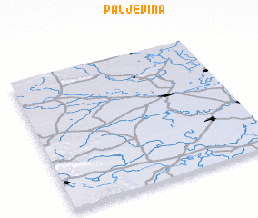 Places with similar names to Paljevina, Croatia ::
Disclaimer :: Information on this page comes without warranty of any kind |
||
|
Where is Paljevina? Elevation and coordinates ::
Latitude (lat): 45°24'20"N Longitude (lon): 18°17'15"E
Elevation (approx.): 136m (map arrows pan, magnifying glasses zoom) |
||
|
Visiting Paljevina? Hotel/Accommodation ::
Book a hotel in Paljevina Travel Guide ::
Buy a travel guide for Croatia rental cars ::
car rental offers GPS waypoint ::
download a GPX waypoint (PoI) of Paljevina for your GPS receiver
|
||