|
search place name
|
||
Trnova (Croatia)Trnova is a town in Croatia. An overview map of the region around Trnova is displayed below.
regional and 3d topo map of Trnova, Croatia ::

Trnova airports ::
The nearest airport is DBV - Dubrovnik, located 43.1 km south east of Trnova.
Other airports nearby include OMO - Mostar (52.5 km north), TIV - Tivat (83.6 km south east), SJJ - Sarajevo (118.8 km north), TGD - Podgorica (124.4 km south east), Nearby towns ::
Ðurjani (0.4km south) //
Mravnica (1.1km north west) //
Banići (1.5km south west) //
Kručica (2.5km south) //
Dužani (2.3km north west) //
Slađenovići (3.0km south) //
Grgurići (3.0km south) //
Barbijerići (3.1km south east) //
Butijeri (3.7km north west) //
Slano (3.5km south east) //
Zatmorje (3.7km north east) //
Banja (4.2km south east) //
Podimoć (4.0km north west) //
Strmica (5.0km north) //
Podgora (4.8km north west) //
Smokovina (3.9km west) //
Kremina Njiva (5.1km north east) //
Podosojnik (5.1km south east) //
Grabovi Do (5.2km north east) //
Čepikuće (5.8km north west) //
Kotezi (5.6km north west) //
Grbljava (5.9km south east) //
Kunja Ljut (6.1km south) //
Gornji Majkovi (5.7km south east) //
Cicrina (6.4km north east) //
Gumanca (5.2km east) //
Osredina (5.9km south east) //
Lisac (5.9km north west) //
Orahov Do (5.4km east) //
[all distances 'as the bird flies' and approximate] 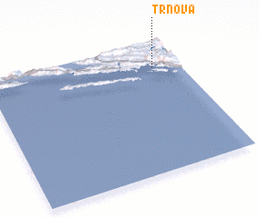 Places with similar names to Trnova, Croatia ::
Disclaimer :: Information on this page comes without warranty of any kind |
||
|
Where is Trnova? Elevation and coordinates ::
Latitude (lat): 42°48'38"N Longitude (lon): 17°51'54"E
Elevation (approx.): 292m (map arrows pan, magnifying glasses zoom) |
||
|
Visiting Trnova? Hotel/Accommodation ::
Book a hotel in Trnova Travel Guide ::
Buy a travel guide for Croatia rental cars ::
car rental offers GPS waypoint ::
download a GPX waypoint (PoI) of Trnova for your GPS receiver
|
||