|
search place name
|
||
Vukosavi (Croatia)Vukosavi is a town in Croatia. An overview map of the region around Vukosavi is displayed below.
regional and 3d topo map of Vukosavi, Croatia ::

Vukosavi airports ::
The nearest airport is OMO - Mostar, located 36.8 km east of Vukosavi.
Other airports nearby include DBV - Dubrovnik (97.8 km south east), SPU - Split (99.0 km north west), SJJ - Sarajevo (103.2 km north east), TIV - Tivat (137.3 km south east), Nearby towns ::
Stinjevac (0.4km south west) //
Barbiri (0.4km north west) //
Dusina (0.7km west) //
Butina (0.9km west) //
Kalajdžići (1.2km north west) //
Veliki Prolog (1.2km east) //
Potprolog (1.6km north) //
Dropulići (1.4km south east) //
Slivetine (1.4km north east) //
Dropulići (1.9km north) //
Draževitići (1.8km south) //
Lučka (1.5km west) //
Milošići (1.7km south east) //
Barbiri (2.4km south) //
Mihaljevići (1.9km north west) //
Jelavići (2.6km north) //
Ilići (2.2km north west) //
Milošići Polje (2.2km south east) //
Vidovići (2.7km north west) //
Prolog (2.5km east) //
Njivetine (2.5km east) //
Umčani (2.7km south west) //
Vina (2.6km west) //
Bijele Zidine (3.0km east) //
Škulja (3.4km north west) //
Luka (4.0km north) //
Klačina (3.4km south east) //
Pasičina (4.1km south) //
Bubni (4.4km north) //
[all distances 'as the bird flies' and approximate] 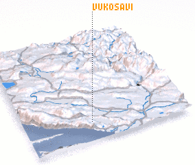
Disclaimer :: Information on this page comes without warranty of any kind |
||
|
Where is Vukosavi? Elevation and coordinates ::
Latitude (lat): 43°10'43"N Longitude (lon): 17°24'55"E
Elevation (approx.): 119m (map arrows pan, magnifying glasses zoom) |
||
|
Visiting Vukosavi? Hotel/Accommodation ::
Book a hotel in Vukosavi Travel Guide ::
Buy a travel guide for Croatia rental cars ::
car rental offers GPS waypoint ::
download a GPX waypoint (PoI) of Vukosavi for your GPS receiver
|
||