|
search place name
|
||
Palodhia (Cyprus)Palodhia is a town in Cyprus. An overview map of the region around Palodhia is displayed below.
regional and 3d topo map of Palodhia, Cyprus ::

Palodhia airports ::
The nearest airport is AKT - Akrotiri, located 17.8 km south of Palodhia.
Other airports nearby include PFO - Paphos Pafos Intl (47.6 km west), LCA - Larnaca (58.5 km east), Nearby towns ::
Paramytha (1.6km north west) //
Spitali (1.9km north) //
Phasoula (2.9km north east) //
Polemidhia Camp (3.7km south) //
Ayia Phyla (4.2km south east) //
Apesha (5.2km north west) //
Mathikoloni (4.6km north east) //
Berengaria Village (5.6km south) //
Pano Polemidhia (5.6km south) //
Apsiou (5.7km north) //
Kato Polemidhia (6.0km south) //
Yerasa (6.0km north) //
Mesayitonia (6.1km south east) //
Ayios Athanasios (5.9km south east) //
Soularavia (6.1km west) //
Korphi (7.2km north west) //
Aloupi (7.5km south) //
Kondovouna (8.9km south) //
Limassol (8.8km south) //
Akrounda (7.5km east) //
Ypsonas (8.5km south west) //
Kokkinoyia (8.0km south east) //
Yermasoyia (7.9km south east) //
Limnatis (8.9km north west) //
Podhimata (8.8km south east) //
Kolossi (11.2km south west) //
[all distances 'as the bird flies' and approximate] 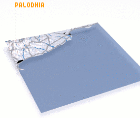
Disclaimer :: Information on this page comes without warranty of any kind |
||
|
Where is Palodhia? Elevation and coordinates ::
Latitude (lat): 34°45'0"N Longitude (lon): 33°0'15"E
Elevation (approx.): 293m (map arrows pan, magnifying glasses zoom) |
||
|
Visiting Palodhia? Hotel/Accommodation ::
Book a hotel in Palodhia Travel Guide ::
Buy a travel guide for Cyprus rental cars ::
car rental offers GPS waypoint ::
download a GPX waypoint (PoI) of Palodhia for your GPS receiver
|
||