|
search place name
|
||
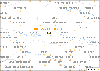
Boissy-le-Châtel (Île-de-France, France)Boissy-le-Châtel is a town in the Île-de-France region of France. An overview map of the region around Boissy-le-Châtel is displayed below.
regional and 3d topo map of Boissy-le-Châtel, France ::
Boissy-le-Châtel airports ::
The nearest airport is CDG - Paris Charles De Gaulle, located 48.0 km north west of Boissy-le-Châtel.
Other airports nearby include LBG - Paris Le Bourget (53.5 km west), ORY - Paris Orly (57.8 km west), CSF - Creil (66.2 km north west), TNF - Toussous-le-noble Toussus Le Noble (75.8 km west), Nearby towns ::
Saint-Germain-sous-Doue (3.9km north) //
Chailly-en-Brie (3.9km south) //
Aulnoy (4.4km north west) //
Marolles-en-Brie (4.4km south east) //
Coulommiers (3.7km west) //
Chauffry (3.7km east) //
Doue (5.7km north) //
Fontenelle (7.4km south) //
La Touche (7.5km south) //
Saint-Siméon (5.2km east) //
La Boullois (7.4km south east) //
LʼÉpauche (7.4km south east) //
Beautheil (8.3km south west) //
Coffery (8.9km south east) //
[all distances 'as the bird flies' and approximate]  Places with similar names to Boissy-le-Châtel, France ::
// Boissey-le-Châtel (FR)
Disclaimer :: Information on this page comes without warranty of any kind |
||
|
Where is Boissy-le-Châtel? Elevation and coordinates ::
Latitude (lat): 48°49'0"N Longitude (lon): 3°8'0"E
Elevation (approx.): 79m (map arrows pan, magnifying glasses zoom) |
||
|
Visiting Boissy-le-Châtel? Hotel/Accommodation ::
Book a hotel in Boissy-le-Châtel Travel Guide ::
Buy a travel guide for France rental cars ::
car rental offers GPS waypoint ::
download a GPX waypoint (PoI) of Boissy-le-Châtel for your GPS receiver
|
||