|
search place name
|
||
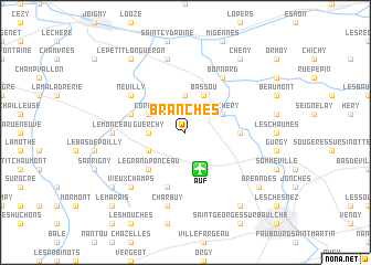
Branches (Bourgogne, France)Branches is a town in the Bourgogne region of France. An overview map of the region around Branches is displayed below.
regional and 3d topo map of Branches, France ::
Branches airports ::
The nearest airport is AUF - Auxerre Branches, located 3.8 km south of Branches.
Other airports nearby include QYR - Troyes Barberey (62.9 km north east), NVS - Nevers Fourchambault (101.8 km south), BOU - Bourges (124.3 km south west), ORY - Paris Orly (125.4 km north west), Nearby towns ::
Guerchy (2.5km west) //
Villemer (3.7km north) //
Fleury-la-Vallée (3.1km south west) //
Cordeil (3.1km north west) //
Chichery (3.1km north east) //
Bassou (3.9km north) //
Le Grand Ponceau (4.5km south west) //
Appoigny (3.7km east) //
Chaumois (5.7km south) //
Champloiseau (4.2km north west) //
Neuilly (5.3km north west) //
Bonnard (6.1km north east) //
La Laye (5.0km west) //
Laduz (5.0km west) //
Le Monceau (5.0km west) //
Charbuy (7.5km south) //
Épineau-les-Voves (7.5km north) //
Vieux Champs (6.7km south west) //
Perrigny (8.3km south east) //
Marnay (7.5km south west) //
Bréandes (7.5km south east) //
Champlay (8.3km north west) //
Le Petit Longueron (8.3km north west) //
Cheny (8.3km north east) //
Le Marais (8.9km south west) //
[all distances 'as the bird flies' and approximate]  Places with similar names to Branches, France ::
Disclaimer :: Information on this page comes without warranty of any kind |
||
|
Where is Branches? Elevation and coordinates ::
Latitude (lat): 47°53'0"N Longitude (lon): 3°29'0"E
Elevation (approx.): 155m (map arrows pan, magnifying glasses zoom) |
||
|
Visiting Branches? Hotel/Accommodation ::
Book a hotel in Branches Travel Guide ::
Buy a travel guide for France rental cars ::
car rental offers GPS waypoint ::
download a GPX waypoint (PoI) of Branches for your GPS receiver
|
||