|
search place name
|
||
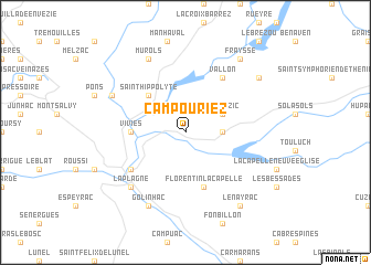
Campouriez (Midi-Pyrénées, France)Campouriez is a town in the Midi-Pyrénées region of France. An overview map of the region around Campouriez is displayed below.
regional and 3d topo map of Campouriez, France ::
Campouriez airports ::
The nearest airport is AUR - Aurillac, located 27.8 km north west of Campouriez.
Other airports nearby include RDZ - Rodez Marcillac (32.4 km south), MEN - Mende Brenoux (75.5 km east), LBI - Albi Le Sequestre (94.5 km south west), LPY - Le Puy Loudes (100.8 km north east), Nearby towns ::
Saint-Amans-des-Cots (2.6km east) //
Montézic (3.2km north east) //
Saint-Hippolyte (4.5km north west) //
Vivies (4.0km west) //
Florentin-la-Capelle (5.7km south) //
Vallon (6.2km north east) //
Entraygues-sur-Truyère (5.4km south west) //
La Plagne (6.8km south west) //
Golinhac (7.9km south) //
Lapeyrugue (6.4km north west) //
Murols (7.9km north) //
Le Nayrac (8.4km south east) //
Saint-Gervais (7.7km north east) //
Fraysse (8.4km north east) //
[all distances 'as the bird flies' and approximate] 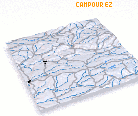 Places with similar names to Campouriez, France ::
// Gumpers (AT)
// Camp Rose (US)
// Campeiros (PT)
// Campo Raso (PT)
// Campo Raso (PT)
// Campo Raso (PT)
// Komparzów (PL)
// Kimpersay (KZ)
// Kampriso (GH)
// Camporosso (IT)
Disclaimer :: Information on this page comes without warranty of any kind |
||
|
Where is Campouriez? Elevation and coordinates ::
Latitude (lat): 44°41'0"N Longitude (lon): 2°37'0"E
Elevation (approx.): 516m (map arrows pan, magnifying glasses zoom) |
||
|
Visiting Campouriez? Hotel/Accommodation ::
Book a hotel in Campouriez Travel Guide ::
Buy a travel guide for France rental cars ::
car rental offers GPS waypoint ::
download a GPX waypoint (PoI) of Campouriez for your GPS receiver
|
||