|
search place name
|
||
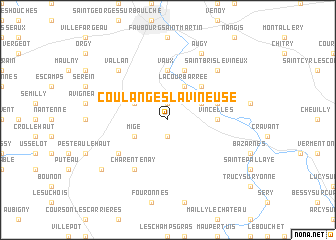
Coulanges-la-Vineuse (Bourgogne, France)Coulanges-la-Vineuse is a town in the Bourgogne region of France. An overview map of the region around Coulanges-la-Vineuse is displayed below.
regional and 3d topo map of Coulanges-la-Vineuse, France ::
Coulanges-la-Vineuse airports ::
The nearest airport is AUF - Auxerre Branches, located 17.9 km north of Coulanges-la-Vineuse.
Other airports nearby include QYR - Troyes Barberey (76.4 km north east), NVS - Nevers Fourchambault (85.3 km south west), BOU - Bourges (116.1 km south west), DIJ - Dijon Longvic (123.3 km east), Nearby towns ::
Jussy (1.9km north) //
Val-de-Mercy (1.9km south) //
La Cour Barrée (3.9km north) //
Champs (3.9km north) //
Gy-lʼÉvêque (3.1km north west) //
Migé (3.1km south west) //
Escolives-Sainte-Camille (3.1km north east) //
Bailly (4.5km north east) //
Vaux (5.6km north) //
Vincelles (3.7km east) //
Petit Vaux (5.7km north) //
Vincelottes (4.2km north east) //
Nanteau (5.3km south west) //
Charentenay (6.1km south west) //
Saint-Bris-le-Vineux (6.7km north east) //
Vallan (6.7km north west) //
Augy (7.8km north) //
Mouffy (7.5km south west) //
[all distances 'as the bird flies' and approximate]  Places with similar names to Coulanges-la-Vineuse, France :: Disclaimer :: Information on this page comes without warranty of any kind |
||
|
Where is Coulanges-la-Vineuse? Elevation and coordinates ::
Latitude (lat): 47°42'0"N Longitude (lon): 3°35'0"E
Elevation (approx.): 185m (map arrows pan, magnifying glasses zoom) |
||
|
Visiting Coulanges-la-Vineuse? Hotel/Accommodation ::
Book a hotel in Coulanges-la-Vineuse Travel Guide ::
Buy a travel guide for France rental cars ::
car rental offers GPS waypoint ::
download a GPX waypoint (PoI) of Coulanges-la-Vineuse for your GPS receiver
|
||