|
search place name
|
||
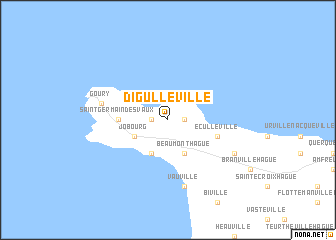
Digulleville (Basse-Normandie, France)Digulleville is a town in the Basse-Normandie region of France. An overview map of the region around Digulleville is displayed below.
regional and 3d topo map of Digulleville, France ::
Digulleville airports ::
The nearest airport is ACI - Alderney, located 25.1 km west of Digulleville.
Other airports nearby include CER - Cherbourg Maupertus (29.1 km east), JER - Jersey (59.7 km south west), GCI - Guernsey (60.8 km south west), CFR - Caen Carpiquet (118.3 km south east), Nearby towns ::
Omonville-la-Petite (1.2km west) //
Omonville-la-Rogue (1.2km east) //
Herqueville (3.9km south) //
Jobourg (3.0km south west) //
Beaumont-Hague (3.9km south) //
Saint-Germain-des-Vaux (3.6km west) //
Éculleville (4.0km south east) //
Goury (5.1km west) //
Auderville (5.1km west) //
Vauville (7.5km south) //
Gréville-Hague (6.1km south east) //
[all distances 'as the bird flies' and approximate]  Places with similar names to Digulleville, France ::
// Teklafalu (HU)
// Tuggleville (US)
Disclaimer :: Information on this page comes without warranty of any kind |
||
|
Where is Digulleville? Elevation and coordinates ::
Latitude (lat): 49°42'0"N Longitude (lon): 1°52'0"W
Elevation (approx.): 44m (map arrows pan, magnifying glasses zoom) |
||
|
Visiting Digulleville? Hotel/Accommodation ::
Book a hotel in Digulleville Travel Guide ::
Buy a travel guide for France rental cars ::
car rental offers GPS waypoint ::
download a GPX waypoint (PoI) of Digulleville for your GPS receiver
|
||