|
search place name
|
||
Girancourt (Lorraine, France)Girancourt is a town in the Lorraine region of France. An overview map of the region around Girancourt is displayed below.
regional and 3d topo map of Girancourt, France ::

Girancourt airports ::
The nearest airport is EPL - Epinal Mirecourt, located 25.4 km north west of Girancourt.
Other airports nearby include ENC - Nancy Essey (58.8 km north), CMR - Colmar Houssen (77.8 km east), ETZ - Metz Nancy Lorraine (90.8 km north), MZM - Metz Frescaty (101.6 km north), Nearby towns ::
Chaumousey (1.2km east) //
Darnieulles (4.5km north east) //
Gorhey (4.5km north west) //
Dommartin-aux-Bois (3.7km west) //
Fomerey (5.7km north) //
Sanchey (4.1km north east) //
Bocquegney (5.7km north) //
Uxegney (5.2km north east) //
Hennecourt (6.1km north west) //
Gigney (7.5km north) //
Les Forges (5.3km east) //
Harol (5.3km west) //
Damas-et-Bettegney (6.7km north west) //
Domèvre-sur-Avière (7.4km north east) //
Charmois-lʼOrgueilleux (8.3km south west) //
[all distances 'as the bird flies' and approximate] 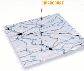 Places with similar names to Girancourt, France ::
// Giringarede (PG)
// Gernicourt (FR)
Disclaimer :: Information on this page comes without warranty of any kind |
||
|
Where is Girancourt? Elevation and coordinates ::
Latitude (lat): 48°10'0"N Longitude (lon): 6°19'0"E
Elevation (approx.): 374m (map arrows pan, magnifying glasses zoom) |
||
|
Visiting Girancourt? Hotel/Accommodation ::
Book a hotel in Girancourt Travel Guide ::
Buy a travel guide for France rental cars ::
car rental offers GPS waypoint ::
download a GPX waypoint (PoI) of Girancourt for your GPS receiver
|
||