|
search place name
|
||
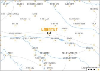
Labatut (Aquitaine, France)Labatut is a town in the Aquitaine region of France. An overview map of the region around Labatut is displayed below.
regional and 3d topo map of Labatut, France ::
Labatut airports ::
The nearest airport is BIQ - Biarritz-bayonne Anglet, located 44.6 km west of Labatut.
Other airports nearby include PUF - Pau Pyrenees (49.4 km east), EAS - San Sebastian (68.8 km west), LDE - Tarbes Lourdes (89.3 km south east), PNA - Pamplona (102.1 km south west), Nearby towns ::
Lahontan (2.3km south east) //
Misson (3.9km north) //
Saint-Cricq-du-Gave (3.3km south west) //
Habas (4.4km north east) //
Pouillon (5.7km north) //
Puyoô (5.7km east) //
Sorde-lʼAbbaye (5.7km west) //
Carresse (7.5km south) //
Cassaber (7.5km south) //
Léren (6.9km south west) //
Bellocq (6.5km south east) //
Saint-Pé-de-Léren (8.4km south west) //
Gaas (8.4km north west) //
Salies-de-Béarn (9.2km south east) //
[all distances 'as the bird flies' and approximate]  Places with similar names to Labatut, France ::
// Labatat (PH)
// Libutad (PH)
// Lebotuto (TP)
// Léboudou Doué (SN)
// La Beatita (PE)
// Labadaad (SO)
// Labatut (FR)
// Labatut (FR)
// La Baitoíta (DO)
// La Batata (DO)
Disclaimer :: Information on this page comes without warranty of any kind |
||
|
Where is Labatut? Elevation and coordinates ::
Latitude (lat): 43°33'0"N Longitude (lon): 0°59'0"W
Elevation (approx.): 48m (map arrows pan, magnifying glasses zoom) |
||
|
Visiting Labatut? Hotel/Accommodation ::
Book a hotel in Labatut Travel Guide ::
Buy a travel guide for France rental cars ::
car rental offers GPS waypoint ::
download a GPX waypoint (PoI) of Labatut for your GPS receiver
|
||