|
search place name
|
||
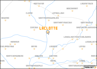
La Clotte (Poitou-Charentes, France)La Clotte is a town in the Poitou-Charentes region of France. An overview map of the region around La Clotte is displayed below.
regional and 3d topo map of La Clotte, France ::
La Clotte airports ::
The nearest airport is BOD - Bordeaux Merignac, located 54.9 km south west of La Clotte.
Other airports nearby include CNG - Cognac Chateaubernard (61.6 km north), EGC - Bergerac Roumaniere (61.9 km south east), ANG - Angouleme Brie Champniers (74.0 km north east), PGX - Perigueux Bassillac (76.5 km east), Nearby towns ::
Saint-Pierre-du-Palais (5.6km north) //
Cercoux (4.3km north west) //
Lagorce (5.7km south) //
Saint-Martin-de-Coux (5.4km north east) //
Les Peintures (6.8km south east) //
Bayas (6.8km south west) //
Le Fouilloux (7.9km north) //
Clérac (9.1km north west) //
[all distances 'as the bird flies' and approximate] 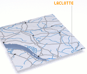 Places with similar names to La Clotte, France ::
// Lagalit (PH)
// Laclede (US)
// La Clede (US)
// Laclede (US)
// La Caleta (PA)
// La Caleta (PA)
// La Gallota (PA)
// La Gallota (PA)
// La Gallota (PA)
// La Gualda (IT)
Disclaimer :: Information on this page comes without warranty of any kind |
||
|
Where is La Clotte? Elevation and coordinates ::
Latitude (lat): 45°7'0"N Longitude (lon): 0°9'0"W
Elevation (approx.): 44m (map arrows pan, magnifying glasses zoom) |
||
|
Visiting La Clotte? Hotel/Accommodation ::
Book a hotel in La Clotte Travel Guide ::
Buy a travel guide for France rental cars ::
car rental offers GPS waypoint ::
download a GPX waypoint (PoI) of La Clotte for your GPS receiver
|
||