|
search place name
|
||
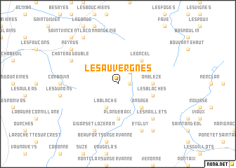
Les Auvergnes (Rhône-Alpes, France)Les Auvergnes is a town in the Rhône-Alpes region of France. An overview map of the region around Les Auvergnes is displayed below.
regional and 3d topo map of Les Auvergnes, France ::
Les Auvergnes airports ::
The nearest airport is VAF - Valence Chabeuil, located 16.7 km west of Les Auvergnes.
Other airports nearby include GNB - Grenoble Saint Geoirs (56.6 km north), OBS - Aubenas-vals-lanas Ardeche Meridionale (72.4 km south west), LYS - Lyon Saint Exupery (95.7 km north), LYN - Lyon Bron (97.2 km north), Nearby towns ::
Le Chaffal (1.3km east) //
La Vacherie (2.3km north east) //
La Blache (3.9km south) //
Léoncel (4.5km north east) //
Ansage (4.5km south east) //
Omblèze (3.9km east) //
Plan-de-Baix (5.6km south) //
Les Blaches (4.4km south east) //
Les Maillets (6.8km south east) //
Châteaudouble (6.4km north west) //
Eygluy (7.9km south) //
Gigors-et-Lozeron (7.9km south) //
Saint-Vincent-la-Commanderie (8.4km north west) //
Peyrus (7.6km north west) //
LʼEscoulin (8.4km south east) //
Charpey (9.1km north west) //
[all distances 'as the bird flies' and approximate] 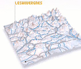 Places with similar names to Les Auvergnes, France ::
// Les Vergnes (FR)
Disclaimer :: Information on this page comes without warranty of any kind |
||
|
Where is Les Auvergnes? Elevation and coordinates ::
Latitude (lat): 44°52'0"N Longitude (lon): 5°10'0"E
Elevation (approx.): 1032m (map arrows pan, magnifying glasses zoom) |
||
|
Visiting Les Auvergnes? Hotel/Accommodation ::
Book a hotel in Les Auvergnes Travel Guide ::
Buy a travel guide for France rental cars ::
car rental offers GPS waypoint ::
download a GPX waypoint (PoI) of Les Auvergnes for your GPS receiver
|
||