|
search place name
|
||
Les Bordes (Bourgogne, France)Les Bordes is a town in the Bourgogne region of France. An overview map of the region around Les Bordes is displayed below.
regional and 3d topo map of Les Bordes, France ::

Les Bordes airports ::
The nearest airport is DIJ - Dijon Longvic, located 39.8 km south east of Les Bordes.
Other airports nearby include XCD - Chalon Champforgeuil (72.3 km south), DLE - Dole Tavaux (75.6 km south east), AUF - Auxerre Branches (96.5 km north west), QYR - Troyes Barberey (106.3 km north west), Nearby towns ::
Boux-sous-Salmaise (1.3km west) //
Bouzot (1.3km west) //
Présilly (1.3km east) //
Salmaise (2.2km south east) //
Blessey (3.1km north east) //
Verrey-sous-Salmaise (3.9km south) //
Thenissey (4.5km north west) //
Vaubuzin (5.6km north) //
Villy-en-Auxois (5.7km south) //
Charencey (5.7km south) //
Charencey Haut (5.7km south) //
Charencey Bas (5.7km south) //
Jailly-les-Moulins (4.2km south west) //
Tiers du Bas (4.2km south west) //
Saint-Germain-Source-Seine (5.3km north east) //
Villotte-Saint-Seine (5.3km south east) //
Villeberny (5.3km south west) //
Tiers du Dessus (5.3km south west) //
Chevannay (7.4km south) //
Frôlois (7.5km north) //
Le Vallon (7.5km north) //
La Bonde (7.5km south) //
Chanceaux (6.7km north east) //
Corpoyer (6.7km north west) //
Corpoyer-la-Chapelle (7.8km north) //
Champrenault (7.8km south) //
Hauteroche (6.2km north west) //
Billy-lès-Chanceaux (8.3km north east) //
Courceau (8.3km north east) //
[all distances 'as the bird flies' and approximate] 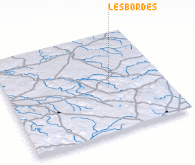 Places with similar names to Les Bordes, France ::
// Las Barretas (PA)
// Las Bordas (PA)
// Las Abiertas (ES)
// Las Bordas (ES)
// Los Barredos (ES)
// Los Britos (CO)
// Los Bordos (GT)
// Los Bordos (GT)
// Los Bordos (GT)
// Las Abritas (MX)
Disclaimer :: Information on this page comes without warranty of any kind |
||
|
Where is Les Bordes? Elevation and coordinates ::
Latitude (lat): 47°28'0"N Longitude (lon): 4°39'0"E
Elevation (approx.): 309m (map arrows pan, magnifying glasses zoom) |
||
|
Visiting Les Bordes? Hotel/Accommodation ::
Book a hotel in Les Bordes Travel Guide ::
Buy a travel guide for France rental cars ::
car rental offers GPS waypoint ::
download a GPX waypoint (PoI) of Les Bordes for your GPS receiver
|
||