|
search place name
|
||
Manthes (Rhône-Alpes, France)Manthes is a town in the Rhône-Alpes region of France. An overview map of the region around Manthes is displayed below.
regional and 3d topo map of Manthes, France ::

Manthes airports ::
The nearest airport is GNB - Grenoble Saint Geoirs, located 26.8 km east of Manthes.
Other airports nearby include VAF - Valence Chabeuil (42.1 km south), LYN - Lyon Bron (47.7 km north), LYS - Lyon Saint Exupery (47.9 km north), EBU - St.-etienne Boutheon (61.2 km north west), Nearby towns ::
Lapeyrouse-Mornay (1.9km north) //
Moras-en-Valloire (2.3km south west) //
Lens-Lestang (3.2km south east) //
La Grande Biesse (3.2km north east) //
Saint-Sorlin-en-Valloire (4.3km south west) //
Le Fer (5.7km north) //
Pact (5.7km north) //
Pourra (5.4km south east) //
Goifieux (6.1km south east) //
Hauterives (6.1km south east) //
Beaurepaire (5.4km north east) //
Jarcieu (5.4km north west) //
Le Guy (7.5km north) //
Les Épars (6.4km south west) //
Les Mételles (7.9km south) //
Tourdan (7.9km north) //
Jangonière (7.6km south east) //
Saint-Sulpice (7.6km north west) //
Poussieu (8.4km north west) //
La Bourretière (9.1km south east) //
[all distances 'as the bird flies' and approximate] 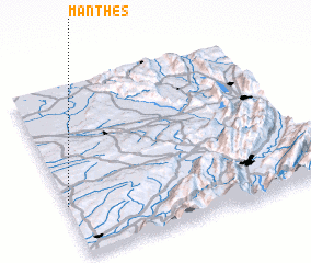 Places with similar names to Manthes, France ::
// Monthois (FR)
// Mounthussey (IE)
Disclaimer :: Information on this page comes without warranty of any kind |
||
|
Where is Manthes? Elevation and coordinates ::
Latitude (lat): 45°18'0"N Longitude (lon): 5°0'0"E
Elevation (approx.): 238m (map arrows pan, magnifying glasses zoom) |
||
|
Visiting Manthes? Hotel/Accommodation ::
Book a hotel in Manthes Travel Guide ::
Buy a travel guide for France rental cars ::
car rental offers GPS waypoint ::
download a GPX waypoint (PoI) of Manthes for your GPS receiver
|
||