|
search place name
|
||
Maure (Auvergne, France)Maure is a town in the Auvergne region of France. An overview map of the region around Maure is displayed below.
regional and 3d topo map of Maure, France ::

Maure airports ::
The nearest airport is MCU - Montlucon Domerat, located 14.9 km south east of Maure.
Other airports nearby include MCU - Montlucon-gueret Montlucon Gueret (23.8 km south), BOU - Bourges (69.5 km north), CHR - Chateauroux Deols (70.9 km north west), XMU - Moulins Montbeugny (78.1 km east), Nearby towns ::
Bouesse (1.3km east) //
Chambérat (1.9km south) //
Armelle (1.3km west) //
Bouyon (2.3km south west) //
Bourzeau (2.3km south west) //
Forgette (2.3km north east) //
La Boutellière (2.3km north east) //
Augère (2.3km north west) //
Palières (2.6km east) //
Pardeux (3.2km south east) //
Les Chiez (3.2km south east) //
La Villette (3.2km north east) //
Courçais (3.9km north) //
Viplaix (3.2km north west) //
Les Fosses (4.5km north west) //
Goélat (5.6km north) //
La Vallas (3.8km east) //
Archignat (5.6km south) //
Les Prugnes (4.3km north east) //
La Croix (5.7km south) //
La Barre (5.3km south west) //
Fareille (6.1km south east) //
Courzadet (5.3km north west) //
Souperons (7.4km north) //
Mesples (5.1km west) //
LʼAge-Goyard (5.1km west) //
Le Liat (7.5km south) //
Saint-Sornin (5.4km east) //
Saint-Désiré (7.5km north) //
[all distances 'as the bird flies' and approximate] 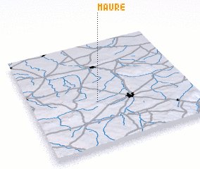 Places with similar names to Maure, France ::
Disclaimer :: Information on this page comes without warranty of any kind |
||
|
Where is Maure? Elevation and coordinates ::
Latitude (lat): 46°26'0"N Longitude (lon): 2°25'0"E
Elevation (approx.): 380m (map arrows pan, magnifying glasses zoom) |
||
|
Visiting Maure? Hotel/Accommodation ::
Book a hotel in Maure Travel Guide ::
Buy a travel guide for France rental cars ::
car rental offers GPS waypoint ::
download a GPX waypoint (PoI) of Maure for your GPS receiver
|
||