|
search place name
|
||
Ognolles (Picardie, France)Ognolles is a town in the Picardie region of France. An overview map of the region around Ognolles is displayed below.
regional and 3d topo map of Ognolles, France ::

Ognolles airports ::
The nearest airport is CSF - Creil, located 55.2 km south west of Ognolles.
Other airports nearby include BVA - Beauvais Tille (62.4 km south west), CDG - Paris Charles De Gaulle (78.8 km south), LBG - Paris Le Bourget (86.1 km south west), POX - Pontoise Cormeilles En Vexin (90.3 km south west), Nearby towns ::
Solente (2.2km north west) //
Margny-aux-Cerises (2.4km west) //
Ercheu (3.0km north east) //
Beaulieu-les-Fontaines (3.9km south) //
Cressy-Omencourt (3.9km north) //
Billancourt (3.9km north) //
Avricourt (4.4km south west) //
Biarre (4.4km north west) //
Balâtre (4.4km north west) //
Moyencourt (4.4km north east) //
Champien (3.6km west) //
Écuvilly (5.7km south) //
Marché-Allouarde (6.1km north west) //
Réthonvillers (6.1km north west) //
Languevoisin-Quiquery (6.1km north east) //
Catigny (6.1km south east) //
Breuil (5.2km north east) //
Roiglise (4.8km west) //
Lagny (7.5km south) //
Candor (7.5km south) //
Herly (7.5km north) //
Carrépuis (5.1km west) //
Libermont (5.1km east) //
Amy (6.1km south west) //
Buverchy (6.1km north east) //
Sermaize (8.2km south east) //
Gruny (7.3km north west) //
Campagne (7.3km south east) //
Beaurains-lès-Noyon (8.8km south east) //
[all distances 'as the bird flies' and approximate] 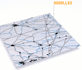 Places with similar names to Ognolles, France ::
// Oak Knolls (US)
// Oak Knolls (US)
Disclaimer :: Information on this page comes without warranty of any kind |
||
|
Where is Ognolles? Elevation and coordinates ::
Latitude (lat): 49°41'0"N Longitude (lon): 2°54'0"E
Elevation (approx.): 112m (map arrows pan, magnifying glasses zoom) |
||
|
Visiting Ognolles? Hotel/Accommodation ::
Book a hotel in Ognolles Travel Guide ::
Buy a travel guide for France rental cars ::
car rental offers GPS waypoint ::
download a GPX waypoint (PoI) of Ognolles for your GPS receiver
|
||