|
search place name
|
||
Puymiclan (Aquitaine, France)Puymiclan is a town in the Aquitaine region of France. An overview map of the region around Puymiclan is displayed below.
regional and 3d topo map of Puymiclan, France ::

Puymiclan airports ::
The nearest airport is EGC - Bergerac Roumaniere, located 37.8 km north east of Puymiclan.
Other airports nearby include AGF - Agen La Garenne (43.8 km south east), PGX - Perigueux Bassillac (85.4 km north east), BOD - Bordeaux Merignac (88.9 km north west), XAC - Arcachon La Teste De Buch (113.8 km west), Nearby towns ::
Jogue (2.3km north east) //
La Vignasse (2.6km east) //
Seyches (3.9km north) //
Bourdets (3.2km south east) //
Agmé (3.9km south) //
Montignac-Toupinerie (4.6km north east) //
Peyrière (5.6km north) //
Saint-Barthélémy-dʼAgenais (4.0km east) //
Pignera (4.4km north east) //
Pierre-Bernat (4.4km south east) //
Birac-sur-Trec (4.4km south west) //
Beffery (6.2km north east) //
Hautesvignes (6.2km south east) //
Labretonie (5.4km south east) //
Saint-Pierre-de-Nogaret (6.2km south west) //
Le Cluzeau (7.4km north) //
Guinot (5.3km east) //
Gontaud (7.5km south) //
Lachapelle (6.8km north west) //
Armillac (6.5km north east) //
Cambes (7.9km north) //
Laborie (8.4km north east) //
Varès (8.4km south east) //
Matelis (9.1km north east) //
[all distances 'as the bird flies' and approximate] 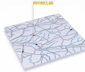 Places with similar names to Puymiclan, France ::
// Pamokolan (ID)
// Pembakulan (ID)
Disclaimer :: Information on this page comes without warranty of any kind |
||
|
Where is Puymiclan? Elevation and coordinates ::
Latitude (lat): 44°31'0"N Longitude (lon): 0°19'0"W
Elevation (approx.): 55m (map arrows pan, magnifying glasses zoom) |
||
|
Visiting Puymiclan? Hotel/Accommodation ::
Book a hotel in Puymiclan Travel Guide ::
Buy a travel guide for France rental cars ::
car rental offers GPS waypoint ::
download a GPX waypoint (PoI) of Puymiclan for your GPS receiver
|
||