|
search place name
|
||
Saint-Jean-de-Daye (Basse-Normandie, France)Saint-Jean-de-Daye is a town in the Basse-Normandie region of France. An overview map of the region around Saint-Jean-de-Daye is displayed below.
regional and 3d topo map of Saint-Jean-de-Daye, France ::

Saint-Jean-de-Daye airports ::
The nearest airport is CFR - Caen Carpiquet, located 50.2 km east of Saint-Jean-de-Daye.
Other airports nearby include CER - Cherbourg Maupertus (52.4 km north west), JER - Jersey (77.4 km west), ACI - Alderney (94.4 km north west), LEH - Le Havre Octeville (94.8 km east), Nearby towns ::
Le Mesnil-Véneron (2.4km west) //
Saint-Fromond (3.0km south east) //
Cavigny (4.4km south east) //
Le Dézert (4.4km south west) //
Neuilly-la-Forêt (4.4km north east) //
La Meauffe (5.7km south) //
Airel (4.1km south east) //
Montmartin-en-Graignes (5.7km north) //
Pont-Hébert (7.4km south) //
Le Mesnil-Angot (5.2km west) //
Graignes (5.2km west) //
Le Hommet-dʼArthenay (6.6km south west) //
Les Oubeaux (7.4km north east) //
Saint-Pellerin (8.3km north west) //
Femelle (8.3km north east) //
Villiers-Fossard (8.9km south east) //
[all distances 'as the bird flies' and approximate] 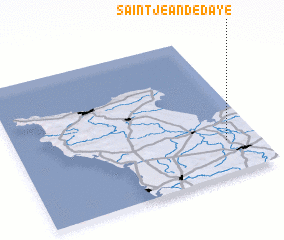 Places with similar names to Saint-Jean-de-Daye, France :: Disclaimer :: Information on this page comes without warranty of any kind |
||
|
Where is Saint-Jean-de-Daye? Elevation and coordinates ::
Latitude (lat): 49°14'0"N Longitude (lon): 1°8'0"W
Elevation (approx.): 28m (map arrows pan, magnifying glasses zoom) |
||
|
Visiting Saint-Jean-de-Daye? Hotel/Accommodation ::
Book a hotel in Saint-Jean-de-Daye Travel Guide ::
Buy a travel guide for France rental cars ::
car rental offers GPS waypoint ::
download a GPX waypoint (PoI) of Saint-Jean-de-Daye for your GPS receiver
|
||