|
search place name
|
||
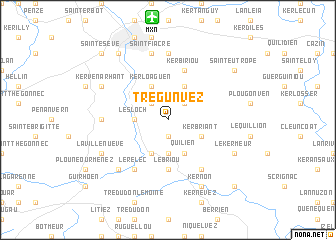
Trégunvez (Bretagne, France)Trégunvez is a town in the Bretagne region of France. An overview map of the region around Trégunvez is displayed below.
regional and 3d topo map of Trégunvez, France ::
Trégunvez airports ::
The nearest airport is MXN - Morlaix Ploujean, located 11.5 km north of Trégunvez.
Other airports nearby include LAI - Lannion (37.2 km north east), BES - Brest Guipavas (46.1 km west), UIP - Quimper Pluguffan (64.5 km south west), SBK - St.-brieuc Armor Armor (70.0 km east), Nearby towns ::
Le Cloître-Saint-Thégonnec (1.9km south) //
Bodister (1.9km south) //
Lestrézec (2.2km north west) //
Kerguz (2.2km north east) //
Coat Miniou (2.2km north east) //
Leslocʼh (2.5km west) //
Créacʼh Ménory (3.7km south) //
Kerbriant (3.1km south east) //
Plourin (3.9km north) //
Kerloaguen (3.9km north) //
Kermorgant (3.9km south) //
Quilien (3.9km south) //
Le Briou (5.6km south) //
Kerbiriou (5.7km north) //
Bouillard (6.1km south east) //
Le Relec (6.1km south west) //
Saint-Divy (7.4km north) //
Pleyber-Christ (4.9km west) //
Saint-Fiacre (7.5km north) //
Le Mengleuz (6.7km south west) //
Kernon (7.8km south) //
Kergreis (6.2km south east) //
Le Kermeur (6.2km south east) //
Kergorre (6.2km south east) //
Kervénarhant (6.2km north west) //
Keryel (6.2km south west) //
La Villenueve (6.2km south west) //
Saint-Eutrope (7.4km north east) //
Kerivin (8.3km north west) //
[all distances 'as the bird flies' and approximate]  Places with similar names to Trégunvez, France ::
// Draganovci (BA)
// Draganovići (BA)
Disclaimer :: Information on this page comes without warranty of any kind |
||
|
Where is Trégunvez? Elevation and coordinates ::
Latitude (lat): 48°30'0"N Longitude (lon): 3°48'0"W
Elevation (approx.): 154m (map arrows pan, magnifying glasses zoom) |
||
|
Visiting Trégunvez? Hotel/Accommodation ::
Book a hotel in Trégunvez Travel Guide ::
Buy a travel guide for France rental cars ::
car rental offers GPS waypoint ::
download a GPX waypoint (PoI) of Trégunvez for your GPS receiver
|
||