|
search place name
|
||
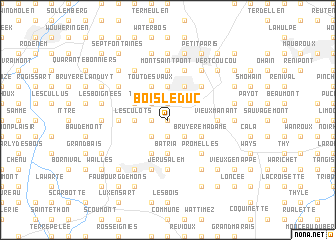
Bois le Duc (Brabant, Belgium)Bois le Duc is a town in the Brabant region of Belgium. An overview map of the region around Bois le Duc is displayed below.
regional and 3d topo map of Bois le Duc, Belgium ::
Bois le Duc airports ::
The nearest airport is CRL - Charleroi Brussels South, located 22.1 km south of Bois le Duc.
Other airports nearby include BRU - Brussels Natl (Melsbroek) (29.2 km north), ANR - Antwerp Deurne (60.4 km north), LGG - Liege (76.2 km east), QKT - Kortrijk-vevelgem Wevelgem (84.1 km west), Nearby towns ::
Lillois-Witterzée (0.0km north) //
Les Belles Pierres (1.2km west) //
Saussois (1.9km north) //
Les Hayettes (1.9km north) //
Cours dʼEau (1.9km south) //
Malplaquée (2.2km south east) //
Trou du Bois (2.2km south east) //
Witterzée (2.2km south west) //
Timpe et Tard (2.2km north west) //
La Bouvrée (2.2km north west) //
Ophain-Bois-Seigneur-Isaac (2.2km north west) //
Chaumont (3.7km south) //
Batria (3.7km south) //
Chennerie (3.7km north) //
Hauts Tiennes (3.7km north) //
Braine-lʼAlleud (3.7km north) //
Rossignol (3.7km north) //
Grange des Champs (3.7km north) //
Estrée (3.7km north) //
Neuville (3.7km north) //
Paradis (3.7km north) //
Flohaye (3.7km north) //
Planche au Pêcheur (3.7km north) //
Les Culots (2.4km west) //
Ménil (3.9km north) //
Merbraine (3.9km north) //
Baulers (3.9km south) //
Bruyère des Berlus (3.0km south east) //
Bruyère Madame (3.0km south east) //
[all distances 'as the bird flies' and approximate]  Places with similar names to Bois le Duc, Belgium ::
// Busletić (BA)
Disclaimer :: Information on this page comes without warranty of any kind |
||
|
Where is Bois le Duc? Elevation and coordinates ::
Latitude (lat): 50°39'0"N Longitude (lon): 4°22'0"E
Elevation (approx.): 130m (map arrows pan, magnifying glasses zoom) |
||
|
Visiting Bois le Duc? Hotel/Accommodation ::
Book a hotel in Bois le Duc Travel Guide ::
Buy a travel guide for Belgium rental cars ::
car rental offers GPS waypoint ::
download a GPX waypoint (PoI) of Bois le Duc for your GPS receiver
|
||