|
search place name
|
||
Cherau (Namur, Belgium)Cherau is a town in the Namur region of Belgium. An overview map of the region around Cherau is displayed below.
regional and 3d topo map of Cherau, Belgium ::

Cherau airports ::
The nearest airport is CRL - Charleroi Brussels South, located 46.5 km north west of Cherau.
Other airports nearby include LGG - Liege (59.3 km north east), BRU - Brussels Natl (Melsbroek) (85.2 km north west), MST - Maastricht (97.5 km north east), LUX - Luxemburg Luxembourg (109.8 km south east), Nearby towns ::
Hulsonniaux (1.2km west) //
Ferage (1.9km south) //
Fond des Veaux (1.9km south) //
Gendron (2.2km north east) //
Pirly (2.2km north east) //
Chaleux (2.2km north west) //
Herhet (2.4km east) //
Mesnil-Église (3.7km south) //
Boisselles (3.9km north) //
Hubermont (3.9km north) //
Furfooz (3.9km north) //
Fin Fourneau (3.9km north) //
Finnevaux (3.9km south) //
Fond de Scrupiat (4.4km south east) //
Mahoux (4.4km south west) //
Wiesme (5.7km south) //
Walzin (4.0km north west) //
Paireux (4.0km north east) //
Houyet (4.0km south east) //
Maisoncelle (5.7km south) //
Les Forges (5.1km north west) //
Celles (5.1km north east) //
Bel Air (5.1km north east) //
Penant (5.1km north west) //
Dréhance (5.1km north west) //
Neffe (5.1km north west) //
Hubaille (5.1km north east) //
Foy-Notre-Dame (6.0km north east) //
Faubourg Saint-Nicolas (6.0km north west) //
[all distances 'as the bird flies' and approximate] 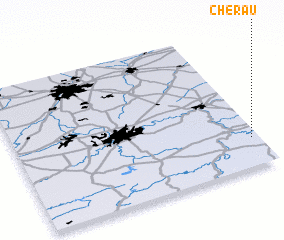 Places with similar names to Cherau, Belgium ::
Disclaimer :: Information on this page comes without warranty of any kind |
||
|
Where is Cherau? Elevation and coordinates ::
Latitude (lat): 50°12'0"N Longitude (lon): 4°58'0"E
Elevation (approx.): 128m (map arrows pan, magnifying glasses zoom) |
||
|
Visiting Cherau? Hotel/Accommodation ::
Book a hotel in Cherau Travel Guide ::
Buy a travel guide for Belgium rental cars ::
car rental offers GPS waypoint ::
download a GPX waypoint (PoI) of Cherau for your GPS receiver
|
||