|
search place name
|
||
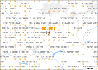
Rovert (Liège, Belgium)Rovert is a town in the Liège region of Belgium. An overview map of the region around Rovert is displayed below.
regional and 3d topo map of Rovert, Belgium ::
nearby GPS traces from timatio ::
Rovert airports ::
The nearest airport is GKE - Geilenkirchen, located 31.0 km north of Rovert.
Other airports nearby include MST - Maastricht (33.7 km north west), LGG - Liege (45.5 km west), MGL - Moenchengladbach Monchengladbach (67.7 km north east), CGN - Cologne Koln Bonn (77.4 km east), Nearby towns ::
Hagbenden (0.0km north) //
Theeheide (1.2km west) //
Belven (1.9km south) //
Eynatten (1.9km north) //
Merols (2.2km south west) //
Pfau (2.2km south east) //
Rott (2.2km south east) //
Neudorf (2.2km south east) //
Berlotte (2.2km north east) //
Walhorn (2.3km west) //
Walhornerheide (2.3km west) //
Katharinenplei (3.7km south) //
Bingelberg Flog (3.7km north) //
Driesch (2.3km east) //
Raeren (2.3km east) //
Busch Brand (3.9km north) //
Hauset (3.9km north) //
Botz (3.0km south east) //
Wesselbend (3.9km north) //
Krieckelberg (3.0km north east) //
Klosei (4.4km south west) //
Kettenis (4.4km south west) //
Hergenrath (4.4km north west) //
Todtleger (4.4km north east) //
Astenet (3.5km west) //
Honien Platz (3.5km east) //
Pützhag (3.5km east) //
Marienthal (3.5km east) //
Hasenell (5.6km south) //
[all distances 'as the bird flies' and approximate]  Places with similar names to Rovert, Belgium ::
Disclaimer :: Information on this page comes without warranty of any kind |
||
|
Where is Rovert? Elevation and coordinates ::
Latitude (lat): 50°41'0"N Longitude (lon): 6°5'0"E
Elevation (approx.): 287m (map arrows pan, magnifying glasses zoom) |
||
|
Visiting Rovert? Hotel/Accommodation ::
Book a hotel in Rovert Travel Guide ::
Buy a travel guide for Belgium rental cars ::
car rental offers GPS waypoint ::
download a GPX waypoint (PoI) of Rovert for your GPS receiver
|
||