|
search place name
|
||
Venn Kreuz (Liège, Belgium)Venn Kreuz is a town in the Liège region of Belgium. An overview map of the region around Venn Kreuz is displayed below.
regional and 3d topo map of Venn Kreuz, Belgium ::

Venn Kreuz airports ::
The nearest airport is GKE - Geilenkirchen, located 37.0 km north of Venn Kreuz.
Other airports nearby include MST - Maastricht (40.2 km north west), LGG - Liege (48.8 km west), MGL - Moenchengladbach Monchengladbach (71.4 km north), CGN - Cologne Koln Bonn (75.8 km east), Nearby towns ::
Stul (1.9km south) //
Mospert (2.4km west) //
Schossent (3.7km north) //
Reinartzhof (3.0km south east) //
Botz (3.9km north) //
Petergensfeld (3.0km north east) //
Pfau (4.4km north west) //
Neudorf (4.4km north west) //
Rott (4.4km north west) //
Ternell (5.6km south) //
Hasenell (3.5km west) //
Honien Platz (5.6km north) //
Pützhag (5.6km north) //
Marienthal (5.6km north) //
Schwerzfeld (4.0km south east) //
Driesch (5.7km north) //
Raeren (5.7km north) //
Katharinenplei (4.0km north west) //
Brand (5.7km north) //
Orsbach (5.7km north) //
Sief (5.7km north) //
Seveneiken (5.1km south west) //
Hill (5.1km south west) //
Belven (5.1km north west) //
Schmidthof (6.0km north east) //
Brandehaag (7.4km south) //
Alt Hattlich (7.4km south) //
Porfays (7.5km south) //
Langes (5.1km west) //
[all distances 'as the bird flies' and approximate] 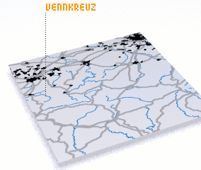 Places with similar names to Venn Kreuz, Belgium ::
// Vinagres (PT)
Disclaimer :: Information on this page comes without warranty of any kind |
||
|
Where is Venn Kreuz? Elevation and coordinates ::
Latitude (lat): 50°38'0"N Longitude (lon): 6°8'0"E
Elevation (approx.): 414m (map arrows pan, magnifying glasses zoom) |
||
|
Visiting Venn Kreuz? Hotel/Accommodation ::
Book a hotel in Venn Kreuz Travel Guide ::
Buy a travel guide for Belgium rental cars ::
car rental offers GPS waypoint ::
download a GPX waypoint (PoI) of Venn Kreuz for your GPS receiver
|
||