|
search place name
|
||
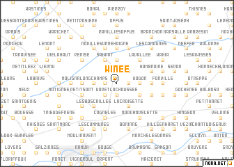
Winée (Namur, Belgium)Winée is a town in the Namur region of Belgium. An overview map of the region around Winée is displayed below.
regional and 3d topo map of Winée, Belgium ::
Winée airports ::
The nearest airport is CRL - Charleroi Brussels South, located 34.9 km west of Winée.
Other airports nearby include LGG - Liege (38.1 km east), BRU - Brussels Natl (Melsbroek) (48.1 km north west), MST - Maastricht (71.4 km north east), ANR - Antwerp Deurne (76.4 km north west), Nearby towns ::
Cortil-Wodon (1.2km east) //
Leuze (1.2km west) //
Corbeau (1.2km west) //
Waret-la-Chaussée (1.9km south) //
Hanret (2.2km north east) //
Rhion (2.2km south west) //
Wodon (2.4km east) //
Bolinne (3.7km north) //
Longchamps (2.4km west) //
Tillier (3.0km south east) //
Éghezée (3.9km north) //
Saiwiat (3.9km north) //
La Croisette (3.9km south) //
La Vallée (4.4km north east) //
Les Boscailles (4.4km south west) //
Bel Air (3.5km east) //
Upigny (3.5km west) //
Taviers (5.6km north) //
Harlue (5.6km north) //
Hambraine (4.0km north east) //
Francqnée (5.7km north) //
Boneffe (5.7km north) //
Champ du Fort Clicot (5.7km north) //
Cognelée (5.7km south) //
Noville-les-Bois (4.0km south east) //
Petit Sart (4.0km south west) //
Noville-sur-Méhaigne (5.7km north) //
Marchovelette (6.0km south east) //
Gelbressée (6.0km south east) //
[all distances 'as the bird flies' and approximate]  Places with similar names to Winée, Belgium ::
Disclaimer :: Information on this page comes without warranty of any kind |
||
|
Where is Winée? Elevation and coordinates ::
Latitude (lat): 50°34'0"N Longitude (lon): 4°55'0"E
Elevation (approx.): 163m (map arrows pan, magnifying glasses zoom) |
||
|
Visiting Winée? Hotel/Accommodation ::
Book a hotel in Winée Travel Guide ::
Buy a travel guide for Belgium rental cars ::
car rental offers GPS waypoint ::
download a GPX waypoint (PoI) of Winée for your GPS receiver
|
||