|
search place name
|
||
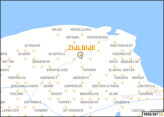
Zijldijk (Groningen, Netherlands)Zijldijk is a town in the Groningen region of Netherlands. An overview map of the region around Zijldijk is displayed below.
regional and 3d topo map of Zijldijk, Netherlands ::
Zijldijk airports ::
The nearest airport is BMK - Borkum, located 22.1 km north of Zijldijk.
Other airports nearby include EME - Emden (30.7 km east), GRQ - Groningen Eelde (33.6 km south), NRD - Norderney (45.9 km north east), LWR - Leeuwarden (69.7 km west), Nearby towns ::
Kolhol (1.1km east) //
Oosternieland (1.1km west) //
Roodeschool (1.9km north) //
ʼt Zandstervoorwerk (1.9km south) //
Hooilandseweg (2.2km north east) //
ʼt Zandt (3.9km south) //
Terhorn (3.9km south) //
Oosteinde (2.9km north east) //
Hefswal (3.9km north) //
Uithuizermeeden (2.9km north west) //
Koningsoord (4.3km north east) //
Zeerijp (5.6km south) //
De Groeve (5.6km south) //
Oldenzijl (3.3km west) //
Heuvelderij (5.6km north) //
Garsthuizen (5.0km south west) //
Godlinze (5.0km south east) //
Leermens (6.0km south) //
Lutjerijp (6.0km south) //
Dekkershuizen (4.4km east) //
Spijk (4.8km south east) //
Eenumerhoogte (7.5km south) //
Eenum (7.5km south) //
Loppersum (7.5km south) //
Startenhuizen (4.8km south west) //
Eppenhuizen (4.8km south west) //
Westeremden (6.5km south west) //
Valom (6.5km north west) //
Losdorp (5.8km south east) //
[all distances 'as the bird flies' and approximate] 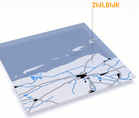 Places with similar names to Zijldijk, Netherlands :: Disclaimer :: Information on this page comes without warranty of any kind |
||
|
Where is Zijldijk? Elevation and coordinates ::
Latitude (lat): 53°24'0"N Longitude (lon): 6°46'0"E
Elevation (approx.): -1m (map arrows pan, magnifying glasses zoom) |
||
|
Visiting Zijldijk? Hotel/Accommodation ::
Book a hotel in Zijldijk Travel Guide ::
Buy a travel guide for Netherlands rental cars ::
car rental offers GPS waypoint ::
download a GPX waypoint (PoI) of Zijldijk for your GPS receiver
|
||