|
search place name
|
||
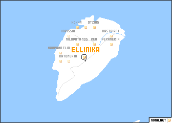
Elliniká (Piraiévs, Greece)Elliniká is a town in the Piraiévs region of Greece. An overview map of the region around Elliniká is displayed below.
regional and 3d topo map of Elliniká, Greece ::
Elliniká airports ::
The nearest airport is JMK - Mykonos Mikonos, located 91.6 km east of Elliniká.
Other airports nearby include SKU - Skiros (152.4 km north), JTR - Santorini (167.8 km south east), JKH - Chios (178.9 km north east), KIT - Kithira (188.1 km south west), Nearby towns ::
Káto Meriá (2.9km west) //
Milopótamos (4.0km north) //
Kéa (4.0km north) //
Píssai (4.4km west) //
Mavrambélion (4.8km north west) //
Korissía (6.3km north west) //
Péra Meriá (5.8km north east) //
Fotimárion (7.4km north) //
Vourkárion (7.4km north) //
Kókka (7.6km north) //
Otziás (7.6km north) //
Kastrianí (7.1km north east) //
[all distances 'as the bird flies' and approximate] 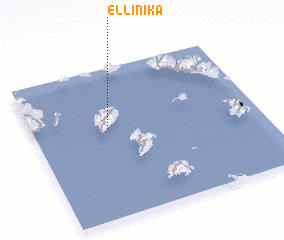 Places with similar names to Elliniká, Greece ::
Disclaimer :: Information on this page comes without warranty of any kind |
||
|
Where is Elliniká? Elevation and coordinates ::
Latitude (lat): 37°36'0"N Longitude (lon): 24°20'0"E
Elevation (approx.): 431m (map arrows pan, magnifying glasses zoom) |
||
|
Visiting Elliniká? Hotel/Accommodation ::
Book a hotel in Elliniká Travel Guide ::
Buy a travel guide for Greece rental cars ::
car rental offers GPS waypoint ::
download a GPX waypoint (PoI) of Elliniká for your GPS receiver
|
||