|
search place name
|
||
Plakídia (Árta, Greece)Plakídia is a town in the Árta region of Greece. An overview map of the region around Plakídia is displayed below.
regional and 3d topo map of Plakídia, Greece ::

Plakídia airports ::
The nearest airport is PVK - Preveza Aktio, located 46.6 km south west of Plakídia.
Other airports nearby include IOA - Ioannina (49.2 km north), AGQ - Agrinion (80.6 km south), CFU - Kerkyra/corfu Ioannis Kapodistrias Intl (103.3 km west), LRA - Larissa Larisa (129.1 km east), Nearby towns ::
Dafnoúla (1.2km north west) //
Dístraton (1.3km east) //
Tzapáda (2.3km south east) //
Délka (2.3km north west) //
Kyprísta (2.4km north west) //
Ámmos (2.8km north west) //
Trapezákion (3.1km north) //
Pérama (3.0km south west) //
Káto Kalentíni (3.4km south) //
Milianá (3.6km south) //
Potistiká (2.9km west) //
(( Fágkos )) (4.1km south) //
(( Andriyiás )) (4.1km south) //
Ptéri (4.3km north) //
Dryón (4.0km south west) //
Katharovoúnion (4.8km north) //
Goniá (3.8km east) //
Lagkádia (4.8km north) //
Anemorráchi (4.4km north east) //
Mégkla (5.3km south) //
Smíxi (4.9km south west) //
Machalás (4.9km north west) //
Perdikárion (5.3km north west) //
Diásella (6.4km south) //
Makhalás (5.1km west) //
Rodavgí (5.8km north west) //
Roumánia (6.0km south west) //
Platánia (5.1km west) //
Pistianá (5.3km west) //
[all distances 'as the bird flies' and approximate] 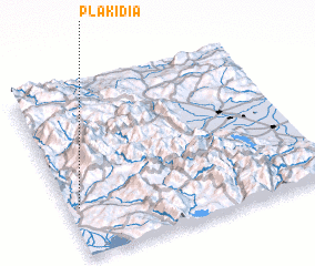 Places with similar names to Plakídia, Greece ::
Disclaimer :: Information on this page comes without warranty of any kind |
||
|
Where is Plakídia? Elevation and coordinates ::
Latitude (lat): 39°17'11"N Longitude (lon): 21°2'24"E
Elevation (approx.): 394m (map arrows pan, magnifying glasses zoom) |
||
|
Visiting Plakídia? Hotel/Accommodation ::
Book a hotel in Plakídia Travel Guide ::
Buy a travel guide for Greece rental cars ::
car rental offers GPS waypoint ::
download a GPX waypoint (PoI) of Plakídia for your GPS receiver
|
||