|
search place name
|
||
Platánistos (Tríkala, Greece)Platánistos is a town in the Tríkala region of Greece. An overview map of the region around Platánistos is displayed below.
regional and 3d topo map of Platánistos, Greece ::

Platánistos airports ::
The nearest airport is IOA - Ioannina, located 44.2 km west of Platánistos.
Other airports nearby include KZI - Kozani Filippos (67.7 km north east), KSO - Kastoria Aristotelis (67.7 km north), LRA - Larissa Larisa (101.6 km east), PVK - Preveza Aktio (111.4 km south west), Nearby towns ::
Korydallós (4.4km south east) //
Panagía (5.0km south east) //
Kallithéa (4.5km east) //
Velónion (5.7km north) //
Malakásion (6.4km south) //
Kranéa (6.9km north) //
Miléa (6.6km west) //
Priónia (7.3km north east) //
Péfki (7.9km south east) //
Matonérion (10.3km south east) //
[all distances 'as the bird flies' and approximate] 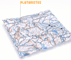 Places with similar names to Platánistos, Greece ::
Disclaimer :: Information on this page comes without warranty of any kind |
||
|
Where is Platánistos? Elevation and coordinates ::
Latitude (lat): 39°50'13"N Longitude (lon): 21°18'18"E
Elevation (approx.): 920m (map arrows pan, magnifying glasses zoom) |
||
|
Visiting Platánistos? Hotel/Accommodation ::
Book a hotel in Platánistos Travel Guide ::
Buy a travel guide for Greece rental cars ::
car rental offers GPS waypoint ::
download a GPX waypoint (PoI) of Platánistos for your GPS receiver
|
||