|
search place name
|
||
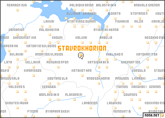
Stavrokhórion (Piraiévs, Greece)Stavrokhórion is a town in the Piraiévs region of Greece. An overview map of the region around Stavrokhórion is displayed below.
regional and 3d topo map of Stavrokhórion, Greece ::
Stavrokhórion airports ::
The nearest airport is AGQ - Agrinion, located 29.8 km south west of Stavrokhórion.
Other airports nearby include PVK - Preveza Aktio (72.4 km west), GPA - Patras Araxos (73.3 km south), PYR - Andravida (100.9 km south), VOL - Nea Anghialos Nea Anchialos (114.8 km north east), Nearby towns ::
Katavóthra (3.7km south) //
Aléstia (3.7km north) //
Kalívai (3.7km north) //
Velotá (2.9km east) //
Pteléa (4.0km north) //
Isómata (3.4km south east) //
Katsidhaíika (3.4km south east) //
Sarkíni (3.4km north east) //
Esokhória (4.7km south east) //
Milonaíika (4.7km north east) //
Velotoúla (4.3km east) //
Ambélia (4.7km south east) //
Parigóris (4.7km south east) //
Pendákorfon (4.7km south west) //
Asprópirgos (4.7km south east) //
Petrotó (5.7km north west) //
Khoúni (5.7km north west) //
Ambélia (5.7km north east) //
Áno Esokhória (6.3km south east) //
Áno Áyios Vlásios (5.8km west) //
Sára Káto Lákka (5.8km east) //
Khelidhón (5.8km east) //
Ayía Triás Goúnari (7.4km north) //
Sídhira (7.6km north) //
Kastanoúla (7.0km south west) //
Ayía Vlakhérna (7.0km north east) //
Vamvakiaí (7.0km north east) //
Karamanaíika (6.9km north west) //
Agalianós (8.0km north) //
[all distances 'as the bird flies' and approximate] 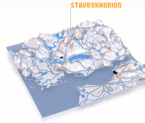 Places with similar names to Stavrokhórion, Greece ::
// Stavrokhórion (GR)
// Stavrokhórion (GR)
Disclaimer :: Information on this page comes without warranty of any kind |
||
|
Where is Stavrokhórion? Elevation and coordinates ::
Latitude (lat): 38°48'0"N Longitude (lon): 21°35'0"E
Elevation (approx.): 639m (map arrows pan, magnifying glasses zoom) |
||
|
Visiting Stavrokhórion? Hotel/Accommodation ::
Book a hotel in Stavrokhórion Travel Guide ::
Buy a travel guide for Greece rental cars ::
car rental offers GPS waypoint ::
download a GPX waypoint (PoI) of Stavrokhórion for your GPS receiver
|
||