|
search place name
|
||
Vatirí (Kardítsa, Greece)Vatirí is a town in the Kardítsa region of Greece. An overview map of the region around Vatirí is displayed below.
regional and 3d topo map of Vatirí, Greece ::

Vatirí airports ::
The nearest airport is PVK - Preveza Aktio, located 64.9 km south west of Vatirí.
Other airports nearby include IOA - Ioannina (70.6 km north west), AGQ - Agrinion (71.1 km south), LRA - Larissa Larisa (102.7 km north east), VOL - Nea Anghialos Nea Anchialos (120.8 km east), Nearby towns ::
Déndros (0.7km north east) //
Loutrá Vragkianón (1.0km north) //
Neochória (1.4km north east) //
Pérdika (1.9km west) //
Grimpianá (2.3km south west) //
Noúles (2.5km east) //
Taxiárchis (3.1km south) //
Miléai (3.1km north west) //
Pýrgos (2.6km west) //
Xerákia (3.0km east) //
Plágia (3.4km south east) //
Katafýllion (4.1km south) //
Sykiá (3.8km south west) //
(( Soufaíika )) (3.4km east) //
Vragkianá (3.4km east) //
Melánydron (3.9km north east) //
Ágios Nikólaos (4.4km north) //
Lagkáda (3.9km north west) //
Kellária (4.5km south) //
Márathos (3.7km north east) //
Ágios Vasíleios (5.1km north east) //
Palaiomýlia (5.1km north west) //
Práva (4.9km south west) //
Pigaí (5.7km north) //
(( Agrámbela )) (4.8km south west) //
Argýrion (5.7km south) //
Ágioi Apóstoloi (4.8km south east) //
Choutianá (5.7km north west) //
Aidoniá (6.0km north) //
[all distances 'as the bird flies' and approximate] 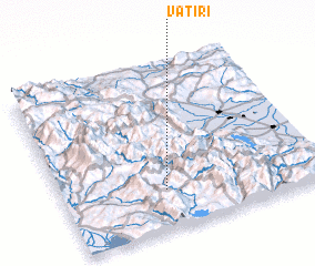 Places with similar names to Vatirí, Greece ::
Disclaimer :: Information on this page comes without warranty of any kind |
||
|
Where is Vatirí? Elevation and coordinates ::
Latitude (lat): 39°14'30"N Longitude (lon): 21°23'44"E
Elevation (approx.): 487m (map arrows pan, magnifying glasses zoom) |
||
|
Visiting Vatirí? Hotel/Accommodation ::
Book a hotel in Vatirí Travel Guide ::
Buy a travel guide for Greece rental cars ::
car rental offers GPS waypoint ::
download a GPX waypoint (PoI) of Vatirí for your GPS receiver
|
||