|
search place name
|
||
Arazede (Coimbra, Portugal)Arazede is a town in the Coimbra region of Portugal. An overview map of the region around Arazede is displayed below.
regional and 3d topo map of Arazede, Portugal ::

Arazede airports ::
The nearest airport is OPO - Porto, located 107.2 km north of Arazede.
Other airports nearby include VRL - Vila Real (135.2 km north east), LIS - Lisbon Lisboa (171.9 km south), VGO - Vigo (216.4 km north), BJZ - Badajoz Talavera La Real (220.4 km south east), Nearby towns ::
Vila Franca (0.0km north) //
Casal do Gaio (0.0km north) //
Gordos (1.4km east) //
Casais do Murteiro (2.3km south east) //
Zambujeiro (2.3km south east) //
Mata (2.3km south west) //
Casal (2.3km north east) //
Casais dos Faíscas (2.8km west) //
Zambujal (2.8km east) //
Quintã (3.7km north) //
Guimera (3.7km north) //
Cadima (3.7km north) //
Carvalheira (3.7km north) //
Aljuriça (3.7km north) //
Bebedouro (3.4km south west) //
Fornos (3.4km south east) //
Palhagueira (3.4km north west) //
Lombo Folar (3.4km north west) //
Pedras Ásperas (3.4km north west) //
Meco (4.0km south) //
Amieiro (4.0km south) //
Póvoa (4.0km north) //
Cabeça Alta (4.7km south west) //
Murraçã (4.7km south east) //
Lemede (4.7km north east) //
Catarruchos (4.2km west) //
Vale Canosa (5.6km south) //
Resgatados (4.6km south west) //
Casais da Bunhosa (4.6km north west) //
[all distances 'as the bird flies' and approximate] 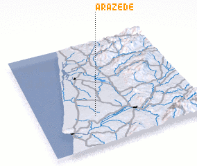 Places with similar names to Arazede, Portugal ::
Disclaimer :: Information on this page comes without warranty of any kind |
||
|
Where is Arazede? Elevation and coordinates ::
Latitude (lat): 40°17'0"N Longitude (lon): 8°39'0"W
Elevation (approx.): 90m (map arrows pan, magnifying glasses zoom) |
||
|
Visiting Arazede? Hotel/Accommodation ::
Book a hotel in Arazede Travel Guide ::
Buy a travel guide for Portugal rental cars ::
car rental offers GPS waypoint ::
download a GPX waypoint (PoI) of Arazede for your GPS receiver
|
||