|
search place name
|
||
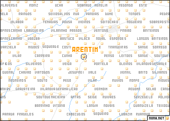
Arentim (Braga, Portugal)Arentim is a town in the Braga region of Portugal. An overview map of the region around Arentim is displayed below.
regional and 3d topo map of Arentim, Portugal ::
Arentim airports ::
The nearest airport is OPO - Porto, located 30.9 km south west of Arentim.
Other airports nearby include VRL - Vila Real (67.9 km east), VGO - Vigo (84.0 km north), BGC - Braganca (153.6 km east), SCQ - Santiago (157.1 km north), Nearby towns ::
Rossas (0.0km north) //
Tebosa (0.0km north) //
Vendas (0.0km north) //
Bicuela (1.4km east) //
Sezures (1.9km south) //
Oliveira (1.4km east) //
Ruilhe (1.4km west) //
Além do Rio (1.4km west) //
Costa (1.4km west) //
Torre (1.9km north) //
Ossada (1.9km north) //
Tadim (1.9km north) //
Carrascos (1.9km north) //
Chascas (1.9km north) //
Monte (1.9km north) //
Arnoso (2.3km south west) //
Macada (2.3km north east) //
Trezeste (2.3km north east) //
Santana de Vimieiro (2.3km north east) //
Carcavelos (2.3km north west) //
Guisande (2.8km east) //
Cunha (2.8km west) //
Vilaça (3.7km north) //
Vale (4.0km south) //
Portela (3.3km south east) //
Jesufrei (4.0km south) //
Pipe (3.3km north east) //
Veiga (3.3km south west) //
Aveleda (4.0km north) //
[all distances 'as the bird flies' and approximate]  Places with similar names to Arentim, Portugal :: Disclaimer :: Information on this page comes without warranty of any kind |
||
|
Where is Arentim? Elevation and coordinates ::
Latitude (lat): 41°29'0"N Longitude (lon): 8°29'0"W
Elevation (approx.): 190m (map arrows pan, magnifying glasses zoom) |
||
|
Visiting Arentim? Hotel/Accommodation ::
Book a hotel in Arentim Travel Guide ::
Buy a travel guide for Portugal rental cars ::
car rental offers GPS waypoint ::
download a GPX waypoint (PoI) of Arentim for your GPS receiver
|
||