|
search place name
|
||
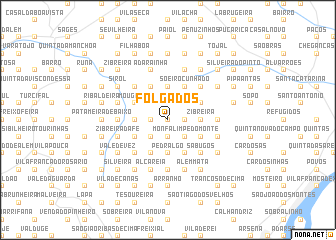
Folgados (Lisboa, Portugal)Folgados is a town in the Lisboa region of Portugal. An overview map of the region around Folgados is displayed below.
regional and 3d topo map of Folgados, Portugal ::
Folgados airports ::
The nearest airport is LIS - Lisbon Lisboa, located 26.1 km south of Folgados.
Nearby towns ::
Chan (0.0km north) //
Pretos (1.4km east) //
Chões (1.9km north) //
Freiria (1.9km north) //
Carneiros (1.4km east) //
Fetais (1.4km east) //
Pinheiro (1.4km west) //
Sobral de Monte Agraço (1.4km west) //
Outeiro (1.4km west) //
Monfalim (1.9km south) //
Adega (1.9km south) //
Folgorosa (2.3km north west) //
Paço (2.3km south east) //
Martim Afonso (2.3km south east) //
São Quintino (2.3km south west) //
Seramena (2.3km south west) //
Almargem (2.3km south west) //
Braçal (3.7km north) //
Carmões (3.7km north) //
Casais dos Tojais (3.7km north) //
Guardamato (3.7km north) //
Palhacana (3.7km north) //
Zibreira (2.9km east) //
Barqueira (2.9km west) //
Pedralgo (3.7km south) //
Batalha (3.7km south) //
Soeiro Cunhado (4.0km north) //
Pereiro da Palhacana (4.0km north) //
Bom Visinho (3.4km north east) //
[all distances 'as the bird flies' and approximate]  Places with similar names to Folgados, Portugal ::
Disclaimer :: Information on this page comes without warranty of any kind |
||
|
Where is Folgados? Elevation and coordinates ::
Latitude (lat): 39°1'0"N Longitude (lon): 9°8'0"W
Elevation (approx.): 263m (map arrows pan, magnifying glasses zoom) |
||
|
Visiting Folgados? Hotel/Accommodation ::
Book a hotel in Folgados Travel Guide ::
Buy a travel guide for Portugal rental cars ::
car rental offers GPS waypoint ::
download a GPX waypoint (PoI) of Folgados for your GPS receiver
|
||