|
search place name
|
||
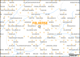
Folhense (Aveiro, Portugal)Folhense is a town in the Aveiro region of Portugal. An overview map of the region around Folhense is displayed below.
regional and 3d topo map of Folhense, Portugal ::
Folhense airports ::
The nearest airport is OPO - Porto, located 58.7 km north west of Folhense.
Other airports nearby include VRL - Vila Real (76.0 km north east), VGO - Vigo (162.5 km north), BGC - Braganca (182.1 km north east), BJZ - Badajoz Talavera La Real (247.5 km south east), Nearby towns ::
Rocas do Vouga (1.9km south) //
Agros (1.4km east) //
Espinheiro (2.3km south west) //
Sanfins (2.3km south east) //
Junqueira (2.3km north east) //
Vila Cova (2.3km north east) //
Chã (2.3km north west) //
Campo de Arca (2.8km east) //
Reguengo (2.8km west) //
Dornelas (2.8km west) //
Nespereira de Baixo (3.7km south) //
Covelo (3.7km south) //
Currais (3.7km north) //
Merlães (3.7km north) //
Mouta (3.4km south east) //
Catives (3.4km south east) //
Silvaescura (3.4km south west) //
Prezas (3.4km south west) //
Gestoso (3.4km north west) //
Vila Seca (4.0km south) //
Couto de Esteves (4.6km south east) //
Vila Fria (4.6km south west) //
Pontemieiro (4.6km north east) //
Cartim (4.6km north west) //
Cepelos (5.6km north) //
Cercal (4.2km east) //
Ermida (5.6km south) //
Arões (4.6km north east) //
Santa Cruz (5.7km north) //
[all distances 'as the bird flies' and approximate]  Places with similar names to Folhense, Portugal :: Disclaimer :: Information on this page comes without warranty of any kind |
||
|
Where is Folhense? Elevation and coordinates ::
Latitude (lat): 40°47'0"N Longitude (lon): 8°21'0"W
Elevation (approx.): 830m (map arrows pan, magnifying glasses zoom) |
||
|
Visiting Folhense? Hotel/Accommodation ::
Book a hotel in Folhense Travel Guide ::
Buy a travel guide for Portugal rental cars ::
car rental offers GPS waypoint ::
download a GPX waypoint (PoI) of Folhense for your GPS receiver
|
||