|
search place name
|
||
Santo Cristo (Portalegre, Portugal)Santo Cristo is a town in the Portalegre region of Portugal. An overview map of the region around Santo Cristo is displayed below.
regional and 3d topo map of Santo Cristo, Portugal ::

Santo Cristo airports ::
The nearest airport is BJZ - Badajoz Talavera La Real, located 69.3 km south east of Santo Cristo.
Other airports nearby include LIS - Lisbon Lisboa (143.4 km west), SVQ - Sevilla (240.8 km south east), OZP - Sevilla Moron Ab (277.1 km south east), Nearby towns ::
Santo António das Paredes (0.0km north) //
Batigelas (2.3km north west) //
Paulos (3.7km south) //
Barreiros (2.9km east) //
Chancelaria (3.7km north) //
Cabeço de Vide (3.4km south west) //
Rodas (4.3km east) //
Vaiamonte (6.3km south east) //
Freiras (6.3km south east) //
Almarjão (6.3km north east) //
Caliços de Cima (7.4km south) //
Monte do Papa Leite (5.7km west) //
Enfermaria (7.6km north) //
Aguilhão (7.6km north) //
Bedanais (6.0km east) //
Romacho (6.0km east) //
Abodaneira (6.8km north east) //
Alter Pedroso (6.8km north west) //
Campino (8.6km north east) //
Monte do Cégo (9.4km south west) //
[all distances 'as the bird flies' and approximate] 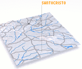 Places with similar names to Santo Cristo, Portugal ::
// Santo Cristo (BR)
// Santo Cristo (CU)
// Santo Cristo (CU)
// Santa Crucita (SV)
// Santo Cristo (HN)
// Santo Cristo (VE)
// Santo Cristo (VE)
// Santo Cristo (VE)
// Santo Cristo (VE)
// Sainte-Christie (FR)
Disclaimer :: Information on this page comes without warranty of any kind |
||
|
Where is Santo Cristo? Elevation and coordinates ::
Latitude (lat): 39°9'0"N Longitude (lon): 7°33'0"W
Elevation (approx.): 302m (map arrows pan, magnifying glasses zoom) |
||
|
Visiting Santo Cristo? Hotel/Accommodation ::
Book a hotel in Santo Cristo Travel Guide ::
Buy a travel guide for Portugal rental cars ::
car rental offers GPS waypoint ::
download a GPX waypoint (PoI) of Santo Cristo for your GPS receiver
|
||