|
search place name
|
||
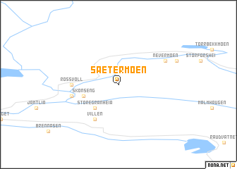
Sætermoen (Nordland, Norway)Sætermoen is a town in the Nordland region of Norway. An overview map of the region around Sætermoen is displayed below.
regional and 3d topo map of Sætermoen, Norway ::
Sætermoen airports ::
The nearest airport is MJF - Mosjoen Kjaerstad, located 84.3 km south west of Sætermoen.
Other airports nearby include SSJ - Sandnessjoen Stokka (98.4 km south west), BOO - Bodoe Bodo (100.7 km north), Nearby towns ::
Store Granheia (4.0km south) //
Skonseng (2.9km south west) //
Villen (5.8km south) //
Røssvoll (3.0km west) //
Reinforsheia (3.5km south west) //
Nevermoen (4.7km north east) //
[all distances 'as the bird flies' and approximate]  Places with similar names to Sætermoen, Norway ::
// Staryy Mayn (RU)
// Steremno (RU)
// Stromyn' (RU)
// Sutormina (RU)
// Sutormino (RU)
// Sutrmino (RU)
// Stremmen (DE)
// Streumen (DE)
// Strímni (GR)
// Store Moen (NO)
Disclaimer :: Information on this page comes without warranty of any kind |
||
|
Where is Sætermoen? Elevation and coordinates ::
Latitude (lat): 66°22'0"N Longitude (lon): 14°24'0"E
(map arrows pan, magnifying glasses zoom) |
||
|
Visiting Sætermoen? Hotel/Accommodation ::
Book a hotel in Sætermoen Travel Guide ::
Buy a travel guide for Norway rental cars ::
car rental offers GPS waypoint ::
download a GPX waypoint (PoI) of Sætermoen for your GPS receiver
|
||