|
search place name
|
||
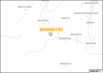
Ban Ai Bu Tae (Narathiwat, Thailand)Ban Ai Bu Tae is a town in the Narathiwat region of Thailand. An overview map of the region around Ban Ai Bu Tae is displayed below.
regional and 3d topo map of Ban Ai Bu Tae, Thailand ::
Ban Ai Bu Tae airports ::
The nearest airport is NAW - Narathiwat, located 55.5 km north of Ban Ai Bu Tae.
Other airports nearby include KBR - Kota Bahru Sultan Ismail Petra (81.2 km east), PAN - Pattani (93.4 km north west), AOR - Alor Setar Sultan Abdul Halim (130.5 km west), HDY - Songkhla Hat Yai Intl (162.7 km north west), Nearby towns ::
Ban Ai Su Rae (5.4km east) //
Ban Ai Ka Se (5.5km north west) //
Ban Ka To (7.7km north east) //
[all distances 'as the bird flies' and approximate]  Places with similar names to Ban Ai Bu Tae, Thailand ::
// Baunu” Bata” (PH)
// Ban Ba Do (TH)
// Ban Boet (TH)
// Ban Boet (TH)
// Ban Bo It (TH)
// Ban Bot (TH)
// Ban Bot (TH)
// Ban Bot (TH)
// Ban Bo To (TH)
// Ban Bua Toei (TH)
Disclaimer :: Information on this page comes without warranty of any kind |
||
|
Where is Ban Ai Bu Tae? Elevation and coordinates ::
Latitude (lat): 6°2'59"N Longitude (lon): 101°34'7"E
Elevation (approx.): 67m (map arrows pan, magnifying glasses zoom) |
||
|
Visiting Ban Ai Bu Tae? Hotel/Accommodation ::
Book a hotel in Ban Ai Bu Tae Travel Guide ::
Buy a travel guide for Thailand rental cars ::
car rental offers GPS waypoint ::
download a GPX waypoint (PoI) of Ban Ai Bu Tae for your GPS receiver
|
||