|
search place name
|
||
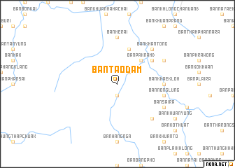
Ban Tao Dam (Surat Thani, Thailand)Ban Tao Dam is a town in the Surat Thani region of Thailand. An overview map of the region around Ban Tao Dam is displayed below.
regional and 3d topo map of Ban Tao Dam, Thailand ::
Ban Tao Dam airports ::
The nearest airport is NST - Nakhon Si Thammarat Cha Ian, located 77.8 km east of Ban Tao Dam.
Other airports nearby include HKT - Phuket Intl (108.7 km west), TST - Trang (110.0 km south), HDY - Songkhla Hat Yai Intl (208.4 km south east), PAN - Pattani (278.1 km south east), Nearby towns ::
Ban Bang Rup (1.9km south) //
Ban Kamyan (2.6km north east) //
Ban Pak Nam (1) (5.2km north east) //
Ban Hin Puan (5.9km north) //
Ban Han Nam Sai (6.6km north east) //
Ban Khaek Lom (7.3km east) //
Ban Merai (7.4km north) //
Ban Nong Lung (7.6km east) //
Ban Khlai Song Chong (7.6km east) //
Ban Khlong Phiang (7.8km south east) //
Ban Khan Tong (7.8km north east) //
Ban Sai Ra (8.2km south east) //
Ban Nong Kok (8.2km north east) //
[all distances 'as the bird flies' and approximate]  Places with similar names to Ban Tao Dam, Thailand ::
// Ban Tao Dam (TH)
// Ban Ta Tum (TH)
// Ban Ta Tum (TH)
// Bendotombo (TD)
// Bindi Adam (PK)
// Bandatama (GN)
// Ban Tadam (LA)
// Ban Tao Tam (LA)
// Bando Taimo (MZ)
Disclaimer :: Information on this page comes without warranty of any kind |
||
|
Where is Ban Tao Dam? Elevation and coordinates ::
Latitude (lat): 8°26'0"N Longitude (lon): 99°15'0"E
Elevation (approx.): 28m (map arrows pan, magnifying glasses zoom) |
||
|
Visiting Ban Tao Dam? Hotel/Accommodation ::
Book a hotel in Ban Tao Dam Travel Guide ::
Buy a travel guide for Thailand rental cars ::
car rental offers GPS waypoint ::
download a GPX waypoint (PoI) of Ban Tao Dam for your GPS receiver
|
||