|
search place name
|
||
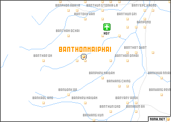
Ban Thon Mai Phai (Thailand)Ban Thon Mai Phai is a town in Thailand. An overview map of the region around Ban Thon Mai Phai is displayed below.
regional and 3d topo map of Ban Thon Mai Phai, Thailand ::
Ban Thon Mai Phai airports ::
The nearest airport is HDY - Songkhla Hat Yai Intl, located 8.8 km north east of Ban Thon Mai Phai.
Other airports nearby include AOR - Alor Setar Sultan Abdul Halim (75.1 km south), PAN - Pattani (89.3 km east), LGK - Pulau Langkawi Intl (90.8 km south west), TST - Trang (107.7 km north west), Nearby towns ::
Dban Not (0.0km north) //
Ban Dan Ngan (0.0km north) //
Ban Lo Lot (0.0km north) //
Ban Mai (0.0km north) //
Ban Chom Lam (0.0km north) //
Ban So To (1.8km west) //
Ban Phru Mai Dam (5.2km south east) //
Ban Khlong Hoi Khong (5.5km east) //
Ban Tha Mo Chai (6.7km north west) //
Ban Mai (6.7km north east) //
Ban Khai Nao (6.7km north east) //
Ban Don Kop (8.3km south west) //
Ban Wang Ching (9.2km south east) //
Ban Klang Na (9.2km north east) //
[all distances 'as the bird flies' and approximate] 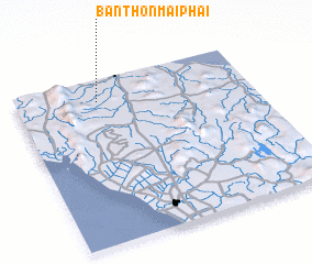 Places with similar names to Ban Thon Mai Phai, Thailand :: Disclaimer :: Information on this page comes without warranty of any kind |
||
|
Where is Ban Thon Mai Phai? Elevation and coordinates ::
Latitude (lat): 6°52'0"N Longitude (lon): 100°21'0"E
Elevation (approx.): 39m (map arrows pan, magnifying glasses zoom) |
||
|
Visiting Ban Thon Mai Phai? Hotel/Accommodation ::
Book a hotel in Ban Thon Mai Phai Travel Guide ::
Buy a travel guide for Thailand rental cars ::
car rental offers GPS waypoint ::
download a GPX waypoint (PoI) of Ban Thon Mai Phai for your GPS receiver
|
||