|
search place name
|
||
Baruchowo (Poland)Baruchowo is a town in Poland. An overview map of the region around Baruchowo is displayed below.
regional and 3d topo map of Baruchowo, Poland ::

Baruchowo airports ::
The nearest airport is WAW - Warsaw Okecie, located 122.3 km east of Baruchowo.
Other airports nearby include GDN - Gdansk Lecha Walesy (217.2 km north), Nearby towns ::
Kurowo (1.9km south) //
Boża Wola (1.1km west) //
Kłótno (1.1km east) //
Probostwo (1.1km east) //
Leonowo (2.2km north west) //
Kłótno Budy (2.2km north east) //
Grodno (2.3km west) //
Szewo Wielkie (2.9km south west) //
Szewo (2.9km south west) //
Szewo Małe (3.9km south) //
Świątkowice (2.9km north west) //
Gulewo (4.3km south east) //
Goreń Mały (4.3km north east) //
Piaski Zawadzkie (3.4km east) //
Krzewent (5.6km north) //
Zawada (3.9km south east) //
Goreń Duży (6.0km north) //
Rakutowo (5.0km north west) //
Wąwał (7.4km south) //
Dobrzelewice (4.5km west) //
Kanibród (7.5km south) //
Władysławów (7.5km south) //
Zakrzewo (4.9km east) //
Więcławice (4.9km west) //
Bilno (6.5km south west) //
Bogusławice (5.8km north west) //
Białotarsk (7.2km south east) //
Skrzyneczki (7.2km north east) //
Rembów Rządowy (8.7km south east) //
[all distances 'as the bird flies' and approximate] 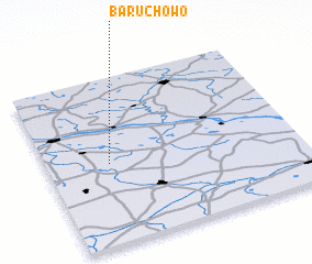 Places with similar names to Baruchowo, Poland ::
// Boruchowo (PL)
Disclaimer :: Information on this page comes without warranty of any kind |
||
|
Where is Baruchowo? Elevation and coordinates ::
Latitude (lat): 52°29'0"N Longitude (lon): 19°15'0"E
Elevation (approx.): 80m (map arrows pan, magnifying glasses zoom) |
||
|
Visiting Baruchowo? Hotel/Accommodation ::
Book a hotel in Baruchowo Travel Guide ::
Buy a travel guide for Poland rental cars ::
car rental offers GPS waypoint ::
download a GPX waypoint (PoI) of Baruchowo for your GPS receiver
|
||