|
search place name
|
||
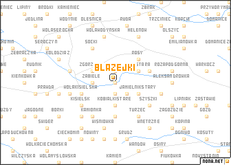
Błażejki (Poland)Błażejki is a town in Poland. An overview map of the region around Błażejki is displayed below.
regional and 3d topo map of Błażejki, Poland ::
Błażejki airports ::
The nearest airport is WAW - Warsaw Okecie, located 76.4 km west of Błażejki.
Other airports nearby include RZE - Rzeszow Jasionka (206.6 km south), Nearby towns ::
Wólka Różańska (0.0km north) //
Toczyska (1.9km north) //
Kobiałki Nowe (1.9km south) //
Jamielnik (2.2km south east) //
Zabiele (2.3km west) //
Kobiałki Stare (3.7km south) //
Zgórznica (2.9km north west) //
Róża Stara (2.9km north east) //
Jamielnik Stary (2.9km south east) //
Rosy (4.4km north east) //
Guzówka (5.6km south) //
Róża Łosiniec (3.9km north east) //
Wola Kisielska (3.9km south west) //
Kamionka (6.0km south) //
Soćki (6.0km north) //
Kisielsk (5.0km south west) //
Turzec (6.0km south) //
Szyszki (5.0km south east) //
Generałowo (4.9km west) //
Wólka Poznańska (4.9km west) //
Wola Wodyńska (7.5km north) //
Stoczek Łukowski (4.9km west) //
Wiśniówka (7.5km south) //
Chrusty (4.9km east) //
Januszówka (6.5km south west) //
Helenów (7.8km north) //
Kolonia Ciechomin (8.2km south west) //
Wnętrzne (8.2km south east) //
[all distances 'as the bird flies' and approximate]  Places with similar names to Błażejki, Poland ::
// Błażejewko (PL)
Disclaimer :: Information on this page comes without warranty of any kind |
||
|
Where is Błażejki? Elevation and coordinates ::
Latitude (lat): 51°58'0"N Longitude (lon): 22°2'0"E
Elevation (approx.): 167m (map arrows pan, magnifying glasses zoom) |
||
|
Visiting Błażejki? Hotel/Accommodation ::
Book a hotel in Błażejki Travel Guide ::
Buy a travel guide for Poland rental cars ::
car rental offers GPS waypoint ::
download a GPX waypoint (PoI) of Błażejki for your GPS receiver
|
||