|
search place name
|
||
Boguszyn (Poland)Boguszyn is a town in Poland. An overview map of the region around Boguszyn is displayed below.
regional and 3d topo map of Boguszyn, Poland ::

Boguszyn airports ::
The nearest airport is WAW - Warsaw Okecie, located 55.4 km south east of Boguszyn.
Other airports nearby include KTW - Katowice Pyrzowice (235.6 km south), GDN - Gdansk Lecha Walesy (246.7 km north west), Nearby towns ::
Łazęki (1.9km north) //
Kolonia Boguszyn (2.2km south east) //
Garwolewo (2.2km south west) //
Janikowo (3.7km south) //
Sobanice (3.9km north) //
Nieborzyn (2.9km north east) //
Raszewo (2.9km north west) //
Parlin (3.9km south) //
Gawarzec Górny (2.9km south west) //
Czerwińsk Nad Wisłą (5.6km south) //
Bitkowice (3.9km north west) //
Wola (5.7km south) //
Srebrna (6.0km north) //
Żukowo (6.0km north) //
Komsin (5.0km south east) //
Gawarzec Dolny (5.0km south west) //
Sielec (5.0km south east) //
Majdany (6.0km south) //
Radzikowo (4.5km east) //
Radzikowo Nowe (4.5km east) //
Radzikowo Stare (4.5km east) //
Radzikowo Scalone (4.5km east) //
Śladów (7.4km south) //
Kobylniki (4.9km west) //
Potyry (7.5km north) //
Nacpolsk (6.5km north west) //
Chmielewo (6.5km south west) //
Zdziarka (6.5km south east) //
Kębłowice (5.8km north east) //
[all distances 'as the bird flies' and approximate] 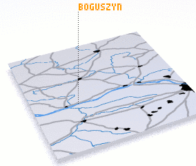
Disclaimer :: Information on this page comes without warranty of any kind |
||
|
Where is Boguszyn? Elevation and coordinates ::
Latitude (lat): 52°27'0"N Longitude (lon): 20°18'0"E
Elevation (approx.): 118m (map arrows pan, magnifying glasses zoom) |
||
|
Visiting Boguszyn? Hotel/Accommodation ::
Book a hotel in Boguszyn Travel Guide ::
Buy a travel guide for Poland rental cars ::
car rental offers GPS waypoint ::
download a GPX waypoint (PoI) of Boguszyn for your GPS receiver
|
||