|
search place name
|
||
Chmielewo (Poland)Chmielewo is a town in Poland. An overview map of the region around Chmielewo is displayed below.
regional and 3d topo map of Chmielewo, Poland ::

Chmielewo airports ::
The nearest airport is WAW - Warsaw Okecie, located 130.2 km south west of Chmielewo.
Other airports nearby include KGD - Kaliningrad Khrabrovo (205.8 km north west), Nearby towns ::
Dzierzgi (0.0km north) //
Sulimy (0.0km north) //
Grądy (1.1km east) //
Korytki Leśne (2.2km south west) //
Nowogród (3.7km north) //
Jankowo (2.2km west) //
Jankowo-Młodzianowo (2.2km west) //
Morgowniki (3.9km north) //
Sulki (4.3km south east) //
Dębniki (4.3km north west) //
Sławiec (3.3km east) //
Łuby Kurki (5.6km south) //
Łuby Kiertany (5.7km south) //
Mątwica (3.8km north east) //
Miastkowo (5.0km south west) //
Leopoldowo (6.0km south) //
Jurki (7.5km north) //
Chojny Naruszczki (6.5km south east) //
Zaruzie (6.5km south west) //
Baliki (7.7km north) //
Zbójna (7.1km north west) //
Młynik (8.1km south east) //
Sosnowiec (8.6km south west) //
[all distances 'as the bird flies' and approximate] 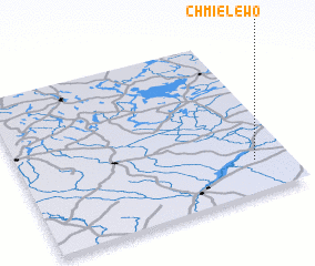 Places with similar names to Chmielewo, Poland ::
Disclaimer :: Information on this page comes without warranty of any kind |
||
|
Where is Chmielewo? Elevation and coordinates ::
Latitude (lat): 53°12'0"N Longitude (lon): 21°52'0"E
Elevation (approx.): 116m (map arrows pan, magnifying glasses zoom) |
||
|
Visiting Chmielewo? Hotel/Accommodation ::
Book a hotel in Chmielewo Travel Guide ::
Buy a travel guide for Poland rental cars ::
car rental offers GPS waypoint ::
download a GPX waypoint (PoI) of Chmielewo for your GPS receiver
|
||