|
search place name
|
||
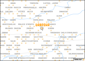
Dąbrowa (Poland)Dąbrowa is a town in Poland. An overview map of the region around Dąbrowa is displayed below.
regional and 3d topo map of Dąbrowa, Poland ::
Dąbrowa airports ::
The nearest airport is KRK - Krakow Balice, located 34.4 km west of Dąbrowa.
Other airports nearby include KTW - Katowice Pyrzowice (98.7 km north west), TAT - Poprad Tatry (103.0 km south), RZE - Rzeszow Jasionka (127.3 km east), KSC - Kosice (165.2 km south east), Nearby towns ::
Gruszki (1.2km west) //
Brzezie (2.2km south west) //
Łysokanie (2.2km south east) //
Szarów (2.4km east) //
Krakuszowice (3.7km south) //
Czyżów (3.0km south west) //
Podborze (3.0km north west) //
Grodkowice (3.0km north east) //
Niepołomice (3.9km north) //
Szczytniki (3.9km south) //
Świdowa (3.9km north) //
Piaski (4.4km north west) //
Podlesie (4.4km north east) //
Zborczyce (4.4km south west) //
Zagórze (3.6km west) //
Cichawa (5.7km south) //
Grobla (5.7km north) //
Staniątki (4.0km north west) //
Boryczów (4.0km north west) //
Suchoraba (4.0km south west) //
Targowisko (4.0km south east) //
Liplas (6.0km south west) //
Wiatowice (6.0km south west) //
Niegowić (7.4km south) //
Wola Batorska (7.5km north) //
Nieznanowice (7.5km south) //
Słomiróg (5.1km west) //
Kłaj (5.1km east) //
Las Kościelnicki (6.6km north west) //
[all distances 'as the bird flies' and approximate]  Places with similar names to Dąbrowa, Poland ::
Disclaimer :: Information on this page comes without warranty of any kind |
||
|
Where is Dąbrowa? Elevation and coordinates ::
Latitude (lat): 50°0'0"N Longitude (lon): 20°15'0"E
Elevation (approx.): 233m (map arrows pan, magnifying glasses zoom) |
||
|
Visiting Dąbrowa? Hotel/Accommodation ::
Book a hotel in Dąbrowa Travel Guide ::
Buy a travel guide for Poland rental cars ::
car rental offers GPS waypoint ::
download a GPX waypoint (PoI) of Dąbrowa for your GPS receiver
|
||