|
search place name
|
||
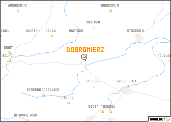
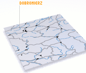
Dobromierz (Poland)Dobromierz is a town in Poland. An overview map of the region around Dobromierz is displayed below.
regional and 3d topo map of Dobromierz, Poland ::
Dobromierz airports ::
The nearest airport is WRO - Wroclaw Strachowice, located 49.2 km north east of Dobromierz.
Other airports nearby include PED - Pardubice (106.8 km south), BBJ - Bautzen (125.2 km west), IEG - Zielona Gora Babimost (139.5 km north), PRG - Prague Ruzyne (167.8 km south west), Nearby towns ::
 Places with similar names to Dobromierz, Poland ::
Disclaimer :: Information on this page comes without warranty of any kind |
||
|
Where is Dobromierz? Elevation and coordinates ::
Latitude (lat): 50°55'0"N Longitude (lon): 16°15'0"E
Elevation (approx.): 267m (map arrows pan, magnifying glasses zoom) |
||
|
Visiting Dobromierz? Hotel/Accommodation ::
Book a hotel in Dobromierz Travel Guide ::
Buy a travel guide for Poland rental cars ::
car rental offers GPS waypoint ::
download a GPX waypoint (PoI) of Dobromierz for your GPS receiver
|
||